The Brúarfoss Waterfall
Most waterfalls in Iceland are well-indicated and easy to find, but Brúarfoss is a bit more secretive and remains a bit of a hidden treasure to this day.
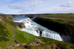
Fortunately, in the last few years, new roads were established that make it easier to get around the area. Great news for visitors as Brúarfoss is probably one of the most beautiful waterfalls in the country. Located in the Laugarvatn and Golden Circle region, you'll find this site in a very busy area along Route 37.

Bruarfoss: Driving through the village
The Internet is rife with testimonies of people who turned back after searching in vain, and many alternate routes to find the waterfall, sometimes hiking even further from Road 37. There are indeed various ways to find it, but this is the simplest in our experience.
Starting from Laugarvatn on Road 37, head towards Geysir and Gullfoss and just after leaving the 355 you'll start to see holiday residences and wooden chalets on the left. This residential estate is where you'll find the small path leading to the waterfall.
You'll drive by 2 entrances closed to visitors, and the 3rd that takes you into the village: it will be indicated “Brekkuskogur”. As you navigate the town, stay far to the left, towards the upper end of the holiday village, which is not necessarily user-friendly for newcomers. After about 1.5 km you'll find a small sign indicating “Bi ALDAN”, take that road for about a minute and continue on the left.
Generally, try to stay close to the river to the west of the village, as it is along this river that lies the small path to the fall.
Very quickly, you will arrive at a cattle grid bridge, the red metal designed to prevent the passage of livestock. You can park nearby, about 20 meters before the gate you'll see a curb on the right side to park 3–4 vehicles.
Once the vehicle has been parked, continue on foot over the cattle grid and leave the main road into the grass. You're almost at the site and this is the first and in fact only indication, a white post with a sign to the waterfall! (see photo)
It'll take less than 10 minutes on foot to get to the waterfall, about a 1-km walk amid the ferns. Cross the small wooden bridge, and you'll start to hear the thunderous sound of the Brúarfoss waterfall. Find the small path leading there, but at this point you can't really miss it, the path is clearly visible.
Even if you don't find it by following this route, as you get near the river, it's pretty intuitive, and you'll have no trouble finding the path. Just in case, we provided a handy the map, above, marking the various key locations.
Useful information to find Bruarfoss:

- Large format card
- Photo of the cattle grid
- Photo of the “Bi ALDAN” sign
- Picture of the Bruarfoss sign
- Photo of the wooden bridge
Alternative: Hike to Bruarfoss

There is a simpler alternative, but this will require a little more effort. Along Route 37 heading west there is a small parking lot just after crossing the Brúara River.
From here, a small path runs north along the river. This hike totals about 3.2 km on a completely flat and easy trail (about 45 minutes). The trail is pleasant and after 2 km will take you past two other waterfalls: Hlauptungufoss, then Miðfoss.
The return is via the same path, so plan for about 1.5 hours for the total walk.
This trail did not exist a few years ago, but it is probably the easiest way to reach the waterfall today!
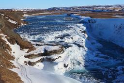
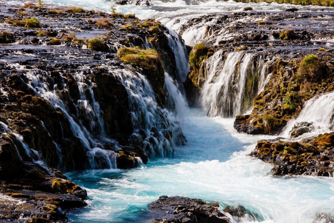
A magnificent waterfall
Once there, a bridge takes you across the river from where you can photograph the waterfall from the top. The colors are magnificent, reminiscent of Hraunfossar where the water is almost turquoise.
By following the bridge to the end, you can even get down to the water level and get those low angle shots of the very photogenic Brúarfoss.