The Strútsfoss Hiking Trail
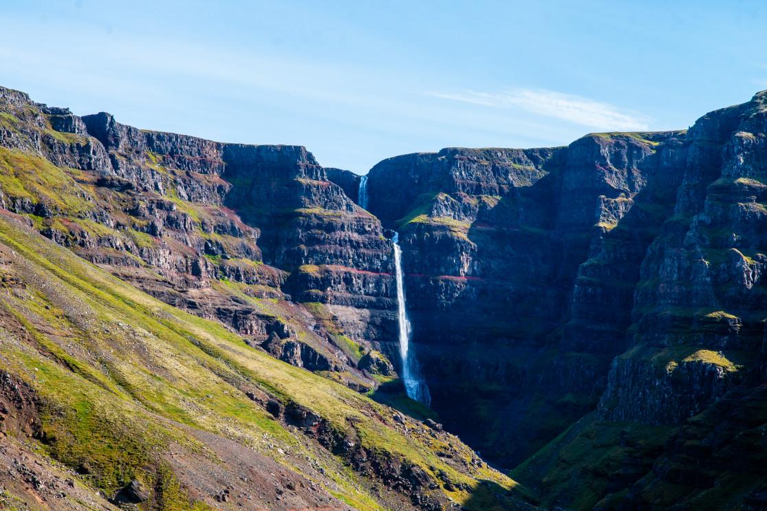
The Strútsfoss waterfall is a beautiful yet little-known waterfall in eastern Iceland, located in the Fljotsdalur valley. Strútsfoss can be seen from afar and it is also one of the highest waterfalls in the country.
Less well known than its neighbor Hengifoss, the Strútsfoss waterfall is definitely worth a visit.
Strútsfoss waterfall

Strútsfoss waterfall
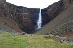
Strútsfoss is a pretty established tourist attraction, in fact it's one of 30 places of interest in the guides certified by the East Iceland Tourist Board. The waterfall is magnificent and in fact has two levels.
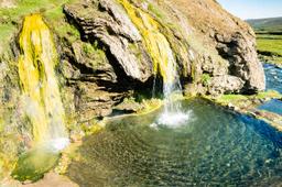
The first cascade is 100 meters high, and the second is about 20 meters. Strútsfoss is often compared to its neighbor Hengifoss, and that's because of the actual type of minerals that make up the stone. The Strútsfoss cliffs are characterised by striking red layers, much like Hengifoss, which makes these places so special.
These red strata in the basaltic rock are in fact sediments, the red color from the oxidation of iron in clay. This geological feature is one of the most beautiful aspects of this valley, the rusted tones layered on the black of the basaltic rocks, all of this framed with lush green vegetation.
The Strútsá River barrels through the deep Strútsgil gorge and falls to merge with the Fellsá River below, and it's a dramatic sight to see this powerful river cascade from such steep cliffs. To its right, Mount Suðurfell rises to an altitude of 663 meters.
When to go and how to get there
While access is often closed in winter, from April you can already get there, and it's particularly charming with the snow.
The best time to go there is between April and October. The waterfall is kind of far from the main roads of eastern Iceland, south of Lagarfljót lake near the Hallormsstaður forest.

From Egilsstaðir, it is very easy to get there, and no need for a 4x4. Go south on the 95 and follow signs to the Lagarfljót lake on Road 931, then continue on the 935 to Sturluflöt.
You'll find a farm with a small car park where the start of the hike is clearly indicated.
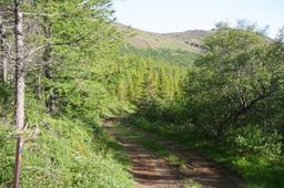
The hike to Strútsfoss

The hike to Strutsfoss
Hiking along this trail is easy, an easygoing loop that starts at the parking lot running east along the Fellsá River.
You can't see the waterfall at first and the trail, perfectly marked with red pegs, has steady elevation for the ascent. After a rocky path, you enter the Strútsgil canyon to reach an idyllic meadow with an enormous cairn with a beautiful view of the waterfall.

Strútsfoss waterfall
The hiking trail stops shortly after the cairn, after a final ascent, but there is no way to get down to the water. The view into the canyon below is truly beautiful.
You'll need a good zoom to get detailed shots of the water, as it's a hundred meters away. Some have started using drones to have a better viewing angle, as risky as that may be.
Count about 1 hour to climb to the waterfall and the same to return, for a total of 7 km there and back.