Hallormsstaður forrest
It's no secret that there are very few trees in Iceland. Forests are a rare sight, representing 0.5% of the territory. Despite major reforestation efforts made in recent years, the landscapes are generally quite free of trees.
It's a good thing Icelanders have a good sense of humour regarding the almost total absence of trees in Iceland:
- Question: “How do you find your way out when you're lost in an Icelandic forest?”
- Answer: “Just stand up...”
Quite amazingly, trees once covered nearly 25% of the island's surface, but the early Viking settlers completely razed the expansive birch forests for construction lumber and toolmaking. It's quite a struggle for trees to grow back in the harsh Icelandic climate, so reforestation efforts have been slow.
Hallormsstaður forest: the largest forest in Iceland

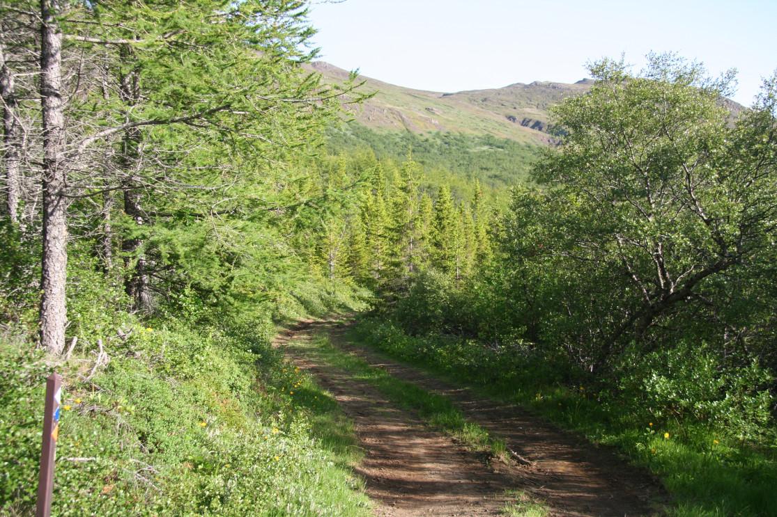
The Hallormsstaður forest (Hallormsstaðarskógur) is actually the only forest in the country that's actually worthy of the title It's obviously become a natural reserve, but also Iceland's first National Forest. The 20th century saw numerous reforestation programs launched and maintained admirably to such an extent that today, the region has more than 12 million trees across 54 different species.
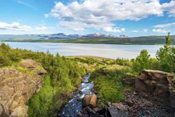
Located in the East of the country, 25 km south of Egilsstaðir along the shores of Lake Logurinn (AKA Lagarfljót), this forest covers more than 2,300 hectares along 18 km of this beautiful lakeside. Several car parks located along the shores of Lake Lagarfljót will connect to various hiking trails that cross this beautiful forest.
Hallormsstaðarskógur hikes
As mentioned, there are numerous hiking trails in the forest to be enjoyed on foot but also for incredible horseback riding excursions. And various campsites along the lake also offer boat rentals, which is a great activity to enjoy with friends and family on Lake Lagarfljót.

No less than 11 hiking trails are listed in the Hallormsstaður forest repertoire:
- The Part (yellow on the map): 3 km
- The Knolls (blue on the map): 5 km
- Hallormsstaður Moors (Orange on the map): 7 km
- Road Forest (Marron on the map): 2 km
- Atlavík Campground (light blue on the map): 1.5 km
- Hallormsstaður Cliffs (light green on the map): 4 km
- The Strain (white on the map): 1.8 km
- Atlavík Corral (red on the map): 1.5 km
- Glacier Stream (brown on the map): 200 m
- Light River Slope (yellow on the map): 850 m
One of the best known is the blue taril, The Knolls, which is 5 km long and climbs from the old School of Economics (now a guest house in summer), past a rocky outcrop known locally as the “Old Woman”, and through the forest to the north.
The path traverses the unusually-named “Flat Forest”, a huge birch forest, before continuing to the Falcon Cliffs which offer a panoramic view of the entire forest. The return trip takes you downhill through a spruce forest to a clearing that was once the Ormsstaðir farm, and from there back to the starting point.