The Sandafell Hike

Nestled in the Vestfirðir peninsula (Westfjords), the hike to the summit of Sandafell is a well-known trek among locals.
Overlooking the peaceful village of Þingeyri, this modest peak offers spectacular views of Dýrafjörður fjord, the surrounding mountains, and the wild plateaus of northwest Iceland.
Little known to most tourists, Sandafell is a must-do for hikers seeking authenticity, solitude, and panoramic vistas.
How to get there
Þingeyri is located in the Westfjords, about 50 km from the town of Ísafjörður. From Ísafjörður, the drive takes just 40 minutes along Route 60, then onto Route 622 after passing the stunning Dýrafjörður fjord.
Access is easy in summer, but during winter, the road can be limited or even completely closed.

The hike map with both parking areas indicated
From the village of Þingeyri, the trailhead is just a few minutes away. You have two parking options:
- Park near the village in a designated lot along the fjord (1 on the map)
- Park farther up in a small lot halfway up the slope, accessible via a 4x4 track (2 on the map)
The green trail on the map adds about 1.5 km to the route and begins near parking area 1. It passes a few houses before wrapping around the base of Sandafell. This section isn’t particularly scenic, so we recommend parking at area 2 for a shorter, more rewarding hike.
The Sandafell hike

The beginning of the Sandafell hike
The Sandafell hike is accessible to most walkers, even those with limited hiking experience. The ascent from parking area 2 to the summit takes about 1 hour to cover the 2.5 km, and around 45 minutes to descend, totaling about 5 km round trip.
The elevation gain is roughly 350 meters. The trail starts out gently through pastures, gradually climbing the grassy slopes of Sandafell.
In dry weather, the path is easy to follow, though it may be slippery in spots with loose rocks or wet grass. While not officially marked, the trail is clearly visible and well-trodden—it’s virtually impossible to get lost. In summer, the hike is especially scenic thanks to the vibrant lupine fields that line the trail.

The superb lupin fields
As you gain elevation, the views over Þingeyri open up. You’ll begin to spot the red and white rooftops of the village, boats in the harbor, and the fjord stretching quietly under shifting Icelandic skies.
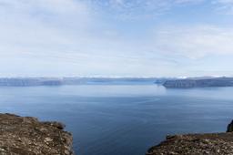
At the summit, you’re rewarded with a truly breathtaking panorama:
- To the west, the open sea and dramatic cliffs plunging into the fjord
- To the north, the rugged mountains that define the Vestfirðir
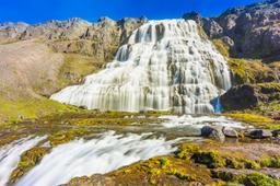
- To the south, sweeping plateaus leading toward the iconic Dynjandi

The view towards the south
At the summit, next to the communications tower, you’ll also find an orientation table that helps identify the surrounding landmarks. On clear days, the sea glitters in the distance, and you might even spot eagles soaring above the fjord.
It’s an ideal place for a picnic—or simply to soak in the serenity and silence of Iceland’s remote landscapes.
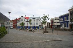
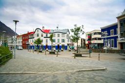
Where to stay Þingeyri

The view towards the north and the village of Thingeyri below - Mino Surkala@dreamstime
Þingeyri offers a few modest but welcoming places to stay:
- Holt Inn & Guesthouse: A cozy guesthouse located a few kilometers from the village with peaceful mountain views. Great for travelers looking for quiet surroundings.
- Simbahöllin Café & Guesthouse: Situated in the heart of Þingeyri, this charming spot offers a handful of cozy rooms and a beloved café. Expect a bohemian vibe and a warm, friendly atmosphere.
For campers, there's also a small campground at the entrance to the village. It’s equipped with toilets, running water, and sometimes even hot showers. The site is well-kept and offers beautiful views of the fjord.
Credit photo top article : Keechuan@dreamstime