Ísafjörður
Ísafjörður is located in the far north-west of Iceland. With around 2,500 inhabitants, it is the most populated city of the region and basically known as the capital of the Westfjords.
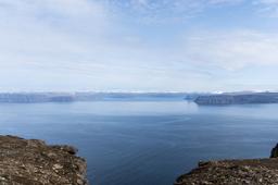
Beautifully positioned between the sea and superb mountains with their tabular shape, the small fishing port is an ideal base camp for tourists who want to explore the local fjords.
- Ísafjörður: a town at the heart of a charming fjord
- How to get to Isafjordur
- Ísafjörður hikes
- Where to stay in Ísafjörður
Ísafjörður: a town at the heart of a charming fjord

The town was exclusively a fishing town until restrictions on the fishing industry in the 1980s, after which Isafjörður saw its population dwindle from 3500 inhabitants to 2500 in 30 years.
Isafjörður is the seat of the municipality of Ísafjarðarbær, which includes the small villages of Thingeyri, Suðureyri and Flateyri. The city is located on a magnificent fjord and offers a superb view of the Isafjardardjup in good weather.
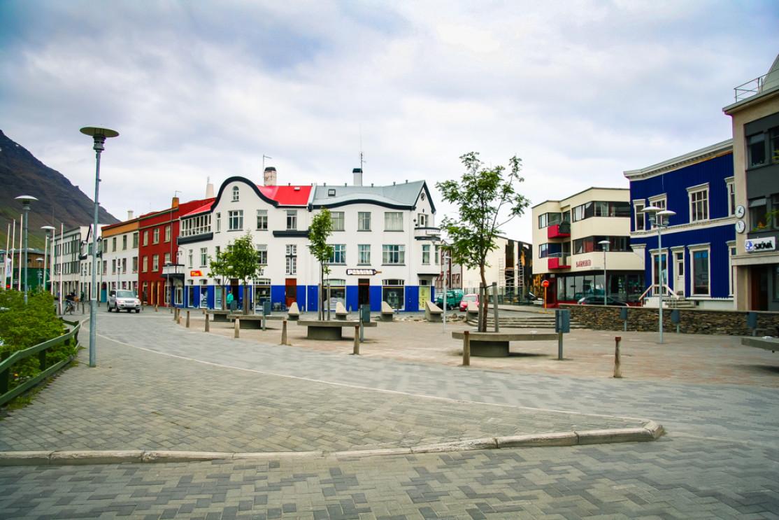
In the center of Isafjörður there are several restaurants and many small shops. The old town is very pleasant to wander, the particular architecture of the wooden houses, typical of the 19th century, gives the place a certain charm that can be appreciated on foot. Like in many small ports in Iceland, the houses are painted in bright colors.
Isafjörður is also known for being the starting point for excursions in the mythical Hornstrandir region.

The center of this small town is home to the Westfjords Maritime Museum which is well worth a visit. The tour is short but interesting, covering the history of fishing in these waters over the centuries. In Isafjorður you will find the Faktorhusið, one of the first prefabricated houses in the country and a local café.
If you feel adventurous, there are some unforgettable excursions here, including kayaking tours from May to October. These kayaking trips generally last 2 hours and depart from Isafjörður. With a little luck you may even encounter one of the seals or whales who inhabit the waters of Isafjarðarðjup.
How to get to Isafjordur
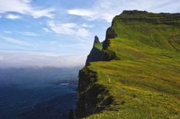
Ísafjörður is located at the northwestern tip of the western fjords, a remote and isolated place where the wilderness reigns supreme.
The only way to reach Ísafjörður by car is to take Road 60 from the south, that becomes Road 61 in the east. From Reykjavík, it takes no less than 5 and a half hours to cover the 450 km to the fjord.
Keep in mind the western fjords are particularly hard to get to get to in winter, which makes it a little more isolated at this time of year.
Isafjordur's hikes

Hiking enthusiasts will be totally spoiled in this region since around Isafjörður there are more than 15 top shelf trails to choose from. There are options for everyone, relaxed 1-hour hikes or more demanding 6-hour trails.
Check out the Isafjordur hiking map, but here are a selected few from shortest to longest:
- A circle at the mouth of Engidalur (Number 6 on map) Duration: 1H, 3 km, no elevation
This trail is probably the most popular as it is so pleasant and easy-going, and to the south, in the Engidalur valley very close to Skutulsfjordur, you will find a small and picturesque creek.
You're likely to spot numerous species of wading birds here, ducks that feed in the shallow waters. And for a touch of dark local history, it is along this promenade (Hopar) that you can visit the execution site of the last sorcerers of Iceland, father and son of Kirkjubol, who were burned at the stake here in 1656.

- Trail to Hnifsdalur (Number 1 on the map) Duration: 3 hours, 5 km, 400 m of elevation
The trail starts in the valley along Heidarbraut road and then along the hillside and the heather-covered slopes. Shortly after Lambaskal, deep in the valley you will discover the ruins of the Fremri-Hnifsdalur farm.
Follow the road almost to Fremri-Hnifsdalur, then cross the Hnifsdalsa river just downstream of the dam and follow the road until you reach the switchback road that winds up the slope. From Heidarskard, you can take the road to Bolungarvik or the one to Thjofaskorð, or turn back.
- Storurd (Number 2 on the map) Duration: 1h30, 3 km, 100 m of elevation
From Silfurtorg, the walk cuts through the city center to Hafnarstraeti, and at the high point of the town stands the church that was built in 1990.
Follow the road to Urdarvegur after which you must leave the asphalt for a track that goes up to Storurd. This slope was once the Isafjordur ski resort.
- Breidadalsheidi - Seljaland to Alftafjordur (Number 5 on the map) Duration: 6h, 14 km, 350m of altitude difference
From Breidadalsheidi you can take any direction... The trail to Alftafjordur is a pleasant one, but at the junction near Botnsheidi just cross the road to find another path to Lake Nonvatn, and we recommend this second option.
It's a moderate hike along the north shore of Nonvatn and the dry plateaus above Engidalur, but when you pass Thoruskard south of Vatnahnjukur, the slope becomes steeper and the path to the pass more complicated. The descent from the pass is very easy, however, meandering along the river to Seljaland (Alftafjordur).
Where to stay in Ísafjördur?

Ísafjörður - Jiri Vondrous @Dreamstime
There are numerous housing options in Ísafjörður. For camping lovers, the Tungudalur campsite is very well known and located very near the city.
The campsite is divided into two parts: a section for mobile homes, campers, and caravans, and another for pitching tents.
As for other types of accommodation, there are plenty guesthouses and hosts for an overnight stop, but for longer stays the Sólheimar Studio or the Private house & Private garden have great value and are located right in the city center.