Ísafjarðardjúp to Drangajökull
When you leave Isafjörður heading east, you arrive at a series of huge fjords grouped under the name of Ísafjarðardjúp. This is the very heart of the Westfjords, each one a gem more superb than the last. Exploring this “Djup” as the Icelanders call it is a rare treat you don't want to miss.
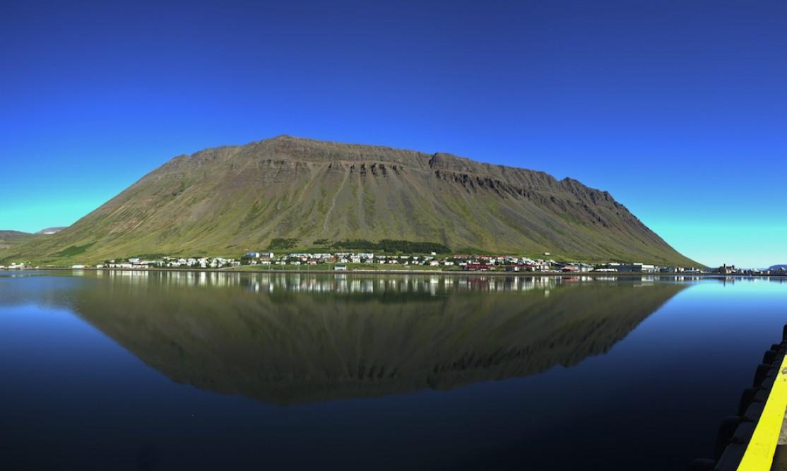
The Isafjardardjup, literally “deep-frozen fjord”, is the largest fjord in the region, 75 km long.
Isafjardardjup: fjord after fjord as far as the eye can see

It is preferable to count on a good two hours to travel through these multiple fjords, sometimes on a road with asphalt, sometimes on a dirt road, but always of good quality: Route 61.
The Ísafjarðardjúp tour is a succession of 10 fjords and starting from Holmavik: Bolungarvík, Skutulsfjörður, Álftafjörður, Seyðisfjörður, Hestfjörður, Skötufjörður, Vatnsfjörður, Reykjarfjörður, Reykjarfjörður and last but not least Ísafjörður.
From the Arnarnes lighthouse, the view over the fjords (plural) is magical and really shows how vast the place is. It is very common to see vehicles stopped on the roadside with the passengers taking pictures, and sometimes a few seals basking!
Road 61 is a delight, each and every panorama a breathtaking work of art and in good weather it's even better. Generally speaking, in this region, you're likely to see a lot of wildlife, especially avifauna: Arctic terns in particular. If you are into birdwatching, there's an ideal little getaway on the small island of Vigur off the fjord. Departures are daily (at 2 pm, departure from Isafjordur) and the tour takes 3 to 4 hours (the boat takes 30 minutes to reach the island from Isafjordur). On the island, you can observe numerous birds such as murres, puffins, eiders and terns. (More information here)
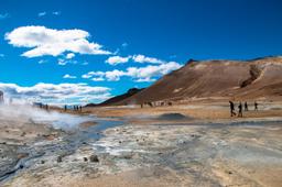
Here again, like everywhere in the Westfjords, there are a few hotpots that are popular with tourists. This is the case in Hörgshlíð in the Mjóifjörður fjord, a small 10m2 pool with water at 38 °C, located along route 61. There is also the one in Heydalur, in the same fjord, which looks more natural, just a pool in the middle of the grassy plain surrounded by a few stones.
On the road to Drangajökull
At the end of the fjords, the road splits in two and you can either continue east on the 61, or approach Drangajökull to the north via the 635. Drangajökull is the only large ice cap in the Westfjords region, totalling 160km² of ice.
The only advantage of taking this detour is for the superb hike that leads to the glacier. The track reaches the bottom of Kaldalon where you can park your 4x4 (off-road vehicles are mandatory).
The duration of the hike is about 3 hours and includes some minor challenges (for example, you have to cross a few shallow streams). The hike starts from Kaldalon Bay just before the bridge... just follow the moraines.
You then enter the nature reserve proper and follow the trail for an hour to a stream. From here you can climb onto the snowfield to enjoy a breathtaking view of the glacial tongue and its waterfalls.
For this hike the elevation is no challenge at all, and the return is by the same route. Just be sure you have the right gear, as the name suggests (Kaldalon = cold lagoon) it can be very cold during the hike. Click through for a map and additional information about this region: here.

Photo credit : Kevin Puget @fotolia