The Kristinartindar Hiking Trail in Skaftafell
The Kristinartindar hiking trail is the best kind of trail, an ascent, and one of the most famous hikes in Skatafell National Park. Named after mount Kristínartindar, a beautiful peak rising to 1126 m and surrounded by several glaciers.
This is a technically challenging hike, and quite a long one too, about 16 km long, so you can count 6 to 8 hours to make the return trip (Camping - Sjonarnipa - Glama - Kristinartindar - Sjonarsker - Camping). The elevation will also represent a full kilometer, so you'll definitely feel that in your legs.
On the map the hike overlaps the S3 “Skaftafellsheiði” trail, but this one is officially referenced as S4 and incorporates Kristínartindar ascent.
Kristinartindar: the most beautiful peak in Skaftafell Park

The circuit starts at the Tourist Center, very close to the campsite. The elevation on this trail is significant, so don't even think about climbing Kristínartindar in bad weather.
The S4 loop can be done in both directions, but we recommend counterclockwise.
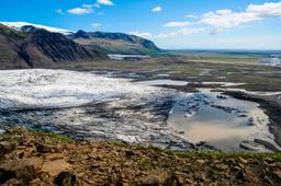
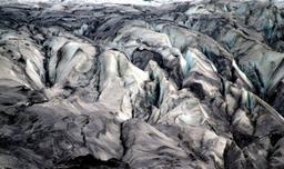
This means starting out heading towards the Sjonarnipa viewpoint. After about an hour through moorland and birch forest, you will come across the breathtaking Sjonarnipa viewpoint with its panorama of the Skaftafelljokull glacier flowing into the sea.
This first section of the hike is not much of a challenge, with about 280 m of elevation between the car park and Sjonarnipa... But that's the end of easy-mode, from here on out, things get hard.
A superb ascent

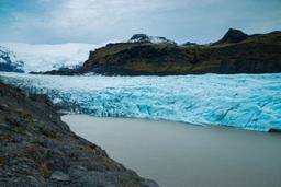
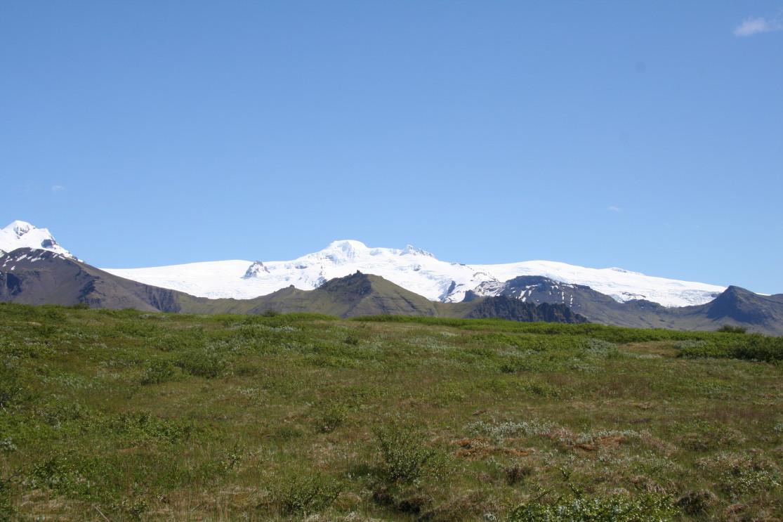
The second leg continues for 1 hour north to the Glama viewpoint, climbing the glacier to reach an altitude of 650 m. This viewpoint is where the two peaks of Kristinartindar are revealed in all their splendour.
Take the first stony path to ascend the smallest peak (980 m), then follow it back down between the two, and complete the final ascent of the highest peak. The ascent is not too technical, but it is demanding, totalling about 1.5 hours from Glama.
The panoramic view from the summit is spectacular with mountains, glacier tongues, and above all the endless expanse of the desert sands as far as the eye can see. Finish the loop going down the same stony path you came up before heading west towards a beautiful meadow.
After ascending Kristinartindar, the rest of the trail is all downhill. That is of course unless you have the stamina to extend the hike to Nyrðrihnukur to admire the beautiful viewpoint, adding another 30 minutes from Kristinartindar.
It takes another 1.5 hours to reach the Sjornasker viewpoint and its magnificent panorama over the Morsardalur valley to the west, then 30 minutes to make it back to the car park.

Photo credit Kristinartindar : defender06@fotolia