The Víknaslóðir Hiking Trails
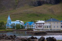
The Eastfjords region is often overlooked by tourists, which is a crying shame as it boasts some of the country's most beautiful and pleasant hiking trails. Indeed, even locals consider Egilsstaðir one of the best regions for hiking in Iceland.
Good to know, the weather in the region is also slightly milder than in the rest of the island, on average a little warmer than Reykjavík.
In the northern part of the Eastern Fjords there is a hiking wonderland called the Víknaslóðir trail, listed by National Geographic as one of the 25 most beautiful treks in the world in 2005.
- The Viknasloðir hiking trails
- The giant boulders of Storurð
- The trail from Borgarfjörður Eystri to Seyðisfjordur
Viknaslodir hikes
The hikes are mainly located between Seydisfjordur and the north of Bakkagerdi, representing a total of 150 kilometers of mostly easy or medium-level trails.
Shelters along the way are particularly well-equipped with running water, a dryer for wet clothes, a 12V charger, comfortable mattresses, well-equipped kitchens, a beautiful dining room and a wood stove.
Historically, this remote region is legendary for being the central province of the Elf Kingdom. Their queen resides there in her fortress, Alfaborg, a charming hill of smooth stones wreathed in flowers which you can visit just behind the small wooden church of Bakkagerdi.

Víknaslóðir trail is not strictly-speaking a trek like the ones Iceland is most famous for, such as the Laugavegur from Landmannalaugar to Thorsmork, but rather a network of hiking trails that can range from a few hours to a few days in the small paradise of Iceland's eastern fjords.
The hikes here are also unlike the harsh terrain found deep in the center of the island, nothing to do with the volcano trails of Landmannalaugar or Kerlingarfjöll. The Eastfjords are all about waterfalls, lakes, coves, canyons, small caves, the seaside, and lush greenery all around you. The majority include mountain trails with lush vegetation and peaks with magnificent views of the fjords.
A few resources:
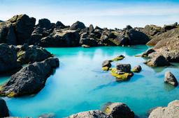
The giant boulders of Storurð

Nearly 50 hiking trails are listed on the map, however some are more famous than others, as is the case with the hikes 8, 9, 10, 11, 13, and 14 that lead to Storurð, or “The Giant Rocks”. This site is located very close to Borgarfjörður Eystri under a small glacier to the west of the Dyrfjöll Mountains with their incredible colors.
This unique natural site consists of gigantic boulders that appear just dropped into these lush green meadows around turquoise ponds. This magnificent panorama is found at the end of a 2.5H hike from the Vatnsskarð pass (see map).
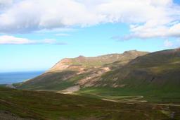
While you could just do a short hike, we recommend you devote at least one day to this region and really pick a few and enjoy the day out. One great combo is to start on trail 9 from Vatnsskarð and return on trail 8 (17 km/5:30 approximately).
This combo starts strong with a steep climb, but after 45 minutes you reach Geldingafjall with an incredible view. The way back down is via a fairly well-marked path for about 1.5H to reach the walls of the fantastic Dyrfjöll mountain range. The path leading then to Storurð is directly indicated. The return is made a descent along the stream and by taking path 8.
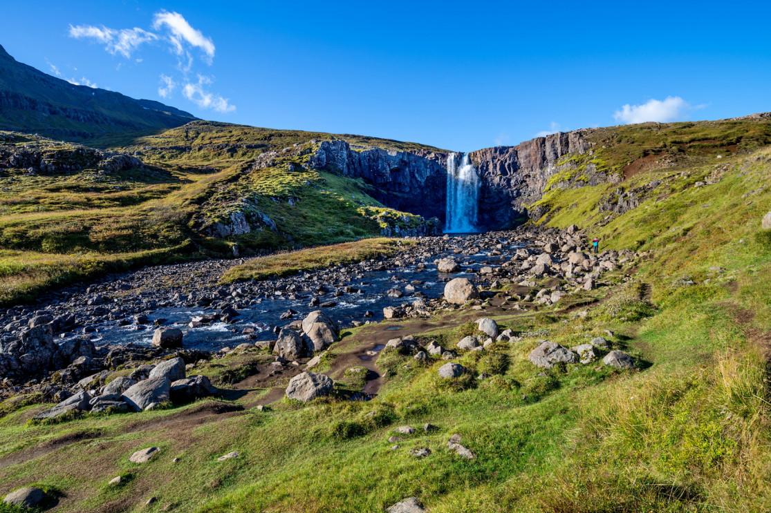
The trail from Borgarfjörður Eystri to Seydisfjordur

The small waterfall near Seyðisfjörður: anderm @fotolia
One of the most popular trails is the 3-day combo leading from Borgarfjörður Eystri to Seydisfjordur.
- Day 1: (15 km) Starting from Kolbeinsfjara, about 4 km from Borgarfjörður, take trail 19 towards the mountains and the Brunavikurskarð Pass. Turn south via trail 21 at Brúnavik, past the magnificent Kerlingfjall, until you reach the Breiðavik refuge after 6 to 7 hours of walking for your first overnight stay.
- Day 2: (13.5 km) Strike out on trail 30 across the green meadows at the foot of Mount Hvitafjall before heading south to the Husavik refuge, where you spend your second night after 6 to 7 hours of walking.
- Day 3: (14 km) Follow trail 37 to the coast of Loðmundarfjörður and the Klyppstaður refuge at the bottom of the fjord. Trail 14 will take you from Loðmundarfjörður to Seydisfjordur through beautiful landscapes surrounded by countless small waterfalls.
It would be a shame not to spend at least a day taking in these landscapes. The scenery is less exotic compared to the dramatic Landmannalaugar for example, but hiking in the eastern fjords around the Dyrfjöll mountain range is truly unforgettable with breathtaking panoramas and contrasts.
Various guides and maps are available at the tourist offices in the following towns: Seydisfjordur, Bakkargerdi or Egilsstadir.