Kverkfjöll: the Volcano, the Glacier, and the Hiking Trails
Deep in the highlands of Iceland lie the “mountains of the gorge”, Kverkfjöll.
The Kverkfjöll mountains are in fact hidden, a subglacial mountain range located between the huge Vatnajökull ice sheet and the Dyngjufjöll mountain in eastern Iceland.
- Kverkfjöll: where fire and ice meet
- How to get to Kverkfjöll?
- The Kverkfjöll ice cave
- The Kverkfjöll hikes
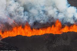
Kverkfjöll: the meeting of fire and ice

Kverkfjöll: Louis Michel Desert©Dreamstime
Rising to an altitude of 1920 meters at the summit of the tallest peak, Skarphédstindur, the Kverkjöll range also includes the volcanoes in the ground. These are still very much active, making this the largest geothermal area in Iceland with its mud pots and hot water rivers near two huge glacial tongues coming from Vatnajökull, namely Brúajárökull and Dyngjujökull.
The Kverkfjöll range showcases the most spectacular phenomena that Iceland can offer: volcanic effusions of all types, geothermal energy with mud pots, lava fields and hot springs, but also ice formations with these impressive glacial tongues. There is even a large geyser that gets very little visitors being so remote, but Gámur is one of the most powerful geysers in Iceland, located in the northern part of the ridge.
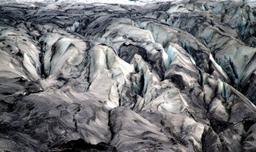
This is the edge of the Earth, where fire and ice battle and remake the landscape literally, as the volcanic heat carved the ice to create ice caves. Unlike those in the south of Vatnajökull, the Kverkfjöll ice caves are unstable, and the interiors cannot be visited safely.
The Jökulsá River in Fjöllum is born of the meltwater from these glaciers, as is the powerful Dettifoss waterfall further north.
How to get to Kverkfjöll
Don't even think about visiting Kverkfjöll in winter, it remains closed and for very good reason. The best time to go there is from July to the end of August, early September at the latest. This isn't the region you pop into to take a few photos and move on, because it's a whole expedition to get there and only equipped with a good 4x4.
Only hiking enthusiasts venture there because the road to get there is something of an adventure.
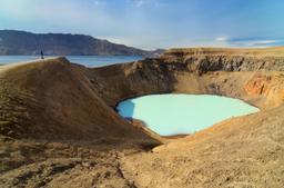
The Kverkfjöll are located in the south of Askja, which is already a remote region. There are two options:
- Getting to Askja via the F88
- Getting to Askja via the F910
A more detailed look at these two routes in our dedicated article:

The Kverkfjöll refuge: Oleksandr Korzhenko©Dreamstime
From Askja, take the F910 for 13 kilometers before turning south on the F910 towards the Hvannalindir oasis. You will then have to take the F902, a jolly and bumpy track, for about 45 kilometers before arriving at the Sigurðarskáli cabin. To travel these 45 kilometers, you need at least 1 hour.
Sigurðarskáli is the parking lot and the refuge for multi-day hikes in the Kverkfjöll range.
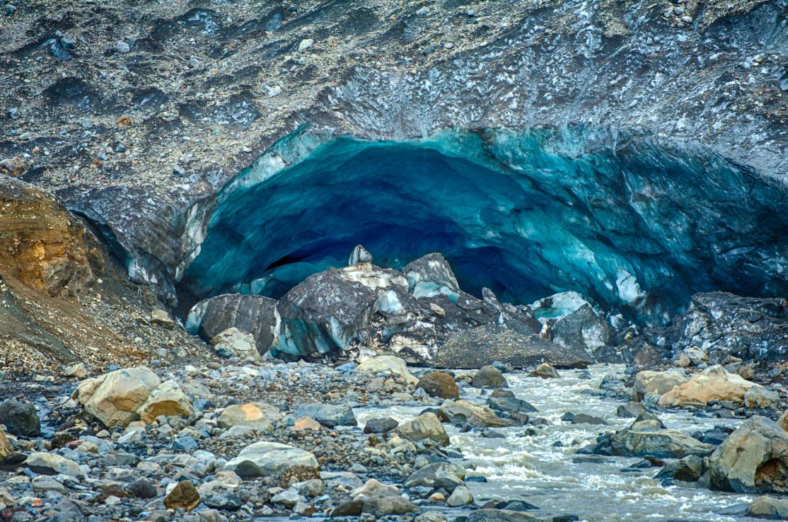
The Kverkfjöll ice cave

The Kverkfjöll ice cave: Filip Fuxa©Dreamstime
Apart from the hikes and treks in the region, Kverkfjöll is known for its beautiful ice cave, Sigurdarskáli, carved out of the glacier by a hot water river. Geothermal heat bored an ice tunnel over nearly 30 km long that is unfortunately not possible to visit, but whose impressive entrance is a sight to behold.
The blue reflections of the cave are absolutely magnificent, and it is possible to get close enough to get some great photographs. Just be sure to respect the safety distance because the site is very unstable, and you don't want to be around when the huge blocks of ice start falling.
There are tours of the area, departing from the car park, with fully guided excursions with safety equipment so as not to take risks.
Kverkfjöll hikes

The Kverkfjöll area is a dreamland for lovers of hikes and treks. Most hiking trails are quite advanced and it is highly recommended to have the necessary equipment including crampons, a compass or GPS, climbing ropes, and adequate eye-wear.
Approach the ice caves and the glacier with great caution due to the risk of falling rocks and ice, deep crevasses, and poor visibility, a dangerous combination.
There are 4 official hikes as you can see on the map:
- K1: Sigurdarskáli hut - ice cave - 500 m
- K2: Sigurdarskáli hut - ice cave by the glacier - 3 km
- K3: Sigurdarskáli hut - Virkisfell - 2.1 km
- K4: Sigurdarskáli hut - Biskupsfell - 9 km (loop)
Visitors often prefer the K2 which crosses lava fields before going along the glacier and the famous ice cave.