Dimmuborgir: The Hike in the Lava Fields
East of Myvatn is an area with impressive geological features, Dimmuborgir, literally "the dark castles", home to an ancient lava field.
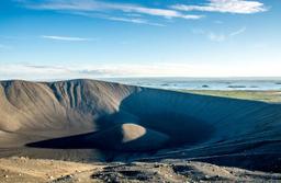
The Mývatn region overlaps with a volcanic zone that extends from Öxarfjörður in the north to the Vatnajökull glacier in the south. The north east of Myvatn, Krafla, is the most active volcanic area.
Volcanic eruptions occur there every hundred of years when the magma under Krafla grumbles and the mountain awakens.
Dimmuborgir: Ancien lava formations

The church, “Kirkja”, in Dimmuborgir
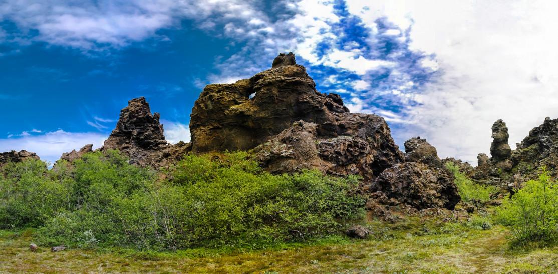
Dimmuborgir is a protected area located about ten kilometers south of the village of Reykjavlíð. These formations were created over 2,300 years ago, as most things in Iceland during a violent volcanic eruption.
Lava flowed into a 12 kilometer-long fissure south of the Hverfjall crater, pooling to create a lava lake that then solidified. Water vapor escaping through the cooling lava created these uniquely incredible columns and the lava sculptures of Dimmuborgir today.
Some of these lava “chambers” are large enough to fit a grown man inside, hence the name “castles”, and there is something magical about these organic, liquid shapes turned to stone. The fantastical landscape is pocked with cones, chimneys, countless crevices and fissures, such that Nordic legends describe the place as the gateway to hell. The place is an untamed wilderness and the vegetation can be surprisingly lush, the greenery contrasting sharply with the black lava structures.
Dimmuborgir is cited in many folk tales in which the rock formations are trolls, ghosts, even elves. According to one of these stories, this is where the famous 13 Icelandic Yule Lads (see our article on Christmas in Iceland) have been living in secret.
How to get to Dimmuborgir
Dimmuborgir is very easy to get to, being just off Road 848 that goes around lake Myvatn, about an hour's drive from Akureyri. Even in winter you can get here easily, and there is a large car park and a souvenir shop.
Dimmuborgir hiking trails

Dimmuborgir Church: Fyle @fotolia
Various trails are available, all well-marked paths to explore Dimmuborgir, and nothing too athletic as the longest is merely 2.4 km long (less than 1 hour of walking). A sign at the parking lot indicates these hikes:
- Small Circle: 550 meters, a 10 or 15-minute walk.
- Big Circle: 850 meters, a 20-minute walk.
- Krókastígur: 800 meters, a 40-minute walk.
- Mellönd Circle: 1200 meters, a 30-minute walk.
- Church Circle: 2,400 meters, a 60-minute walk.
The various trails are all very easy and family-friendly. The longest is of course the most rewarding, and shows you the “Kirkjan” (church) of Dimmuborgir, a particularly astonishing lava formation and the most famous one in Dimmuborgir.
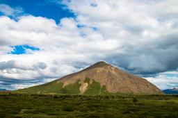
Those with the energy can actually hike to Dimmuborgir on foot from the village of Reykjavlíð, for a total of 14 kilometers and a good 3 hours of walking. In Reykahlíð look for the small hiking trail at the junction with Road number 1, which takes you to Grjótagjá and its hot springs and then to the foot of the Hverfjall crater, which dominates the region.
Hike up the crater to then hike down the other side to continue the remaining 8 kilometers to Dimmuborgir. You can actually skip this ascent to the crater rim, but the view from the summit is definitely worth the detour.

Dimmuborgir : homocosmicos@fotolia