The Glymur Waterfall
Towering at 196 meters, Glymur was as far as anyone knew the highest waterfall in the country. This was true until 2007 when a new waterfall was discovered in Vatnajökull National Park, the mighty Morsárfoss standing at 227 meters high.
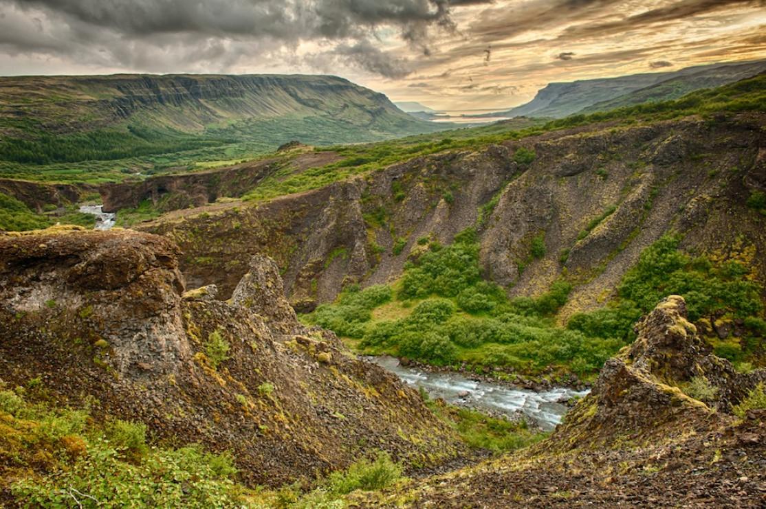
Paradoxically, this waterfall is a bit of a hidden treasure, often forgotten by tourists because it's a bit harder to get to than other waterfalls in the south.
How to get to the waterfall
Located in the heart of the Hvalfjörður fjord, Glymur is the closest waterfall to Reykjavik, located only about 65 km from the capital or a 1H drive.
To get there, head towards Mosfellsbaer north of the capital before turning off onto the beautiful Road 47 that runs along the fjord.
You'll need to walk 1 hour to reach the waterfall, which is hidden in a canyon. This trail to Glymur is a great idea for visitors looking for a short hike near Reykjavík.
Visitors generally leave their vehicles in Botnsa, the car park is large enough to accommodate many vehicles and a starting point for various hikes.
A magnificent hiking trail

Glymur: dadiolafs @fotolia
Several hikes are possible starting from the car park, including the “Leggjabrjótur” trail.
There are two main hiking trails leading to the waterfall, one from the west and the other from the east.
The hike to Glymur is beautiful, but the going is tough. It is strongly recommended you equip yourself with good walking shoes, because some passages are a bit steep and can get slippery in the rain. It takes about 3 hours to complete the 7 kilometers of this trail.
The path will take you up a hill, along a cliff edge, and then through a cave... At this point, there are 2 ways to reach the waterfall:
- The north side
- The south side
We recomment the southern path because the view of the waterfall is much better, and once at the top, you can actually go back down on the other side in any case.
From the south side, after a 30-minute walk from the car park through the superb lupin fields you'll go down through a small cave to a waterway, the Botnsá River. This is where the trail stops being family-friendly. The bridge across is no more than a wooden log and a rope. Hikers have to go one by one to reach the other side. Some families have at this point had to turn back as it turned out to be too difficult for a young child in their party without risking losing balance and slipping into the water.
The path continues along the riverbank, along the pebble shore, to arrive at a small and fairly easy climb that leads to the first viewpoint.

So you'll have to cover 3 kilometers to even see a drop of this impressive waterfall, which is nearly 200 meters tall. It's quite an experience, the landscape around it almost as impressive as the waterfall itself. The Glymur's waters plunge 200 meters down into a narrow canyon with the most deafening roar.
Continue uphill for another quarter of an hour to reach the second viewpoint. This is the fork in the road mentioned earlier. You can go back down the way you came or cross the river (safely) to take the north trail to get back to your car. This return trip in the middle of the birch forest with a view over the whole fjord is the perfect way to finish the hike.
The Glymur hike: Fyle@Fotolia.com