The Nesjavellir Hike

Nesjavellir is a significant geothermal area located near Iceland’s capital, Reykjavik, just southwest of the expansive Lake Þingvallavatn.
Although it’s easy to reach, the region remains relatively off the radar for most visitors—despite offering a scenic hiking trail filled with striking geothermal features.
How to get there
From Reykjavik, the drive takes around 45 to 60 minutes. Follow Route 1 east, then turn onto Route 36 toward Þingvellir. From there, take Route 360, and finally the small Road 435 all the way to Nesjavellir. This last section winds through moss-covered lava fields as it climbs gently into the Highlands.
In summer, the road is paved all the way to the end and easily accessible by regular car. In winter, however, it can become impassable without a properly equipped 4x4.
If you're coming from the south, starting in Selfoss, it takes only about 30 minutes. Take Route 35 north, then turn onto Route 350 heading toward Lake Þingvallavatn. From there, turn left onto Route 360 before reaching Road 435.
There are three parking areas along Route 435 overlooking the geothermal power station, and any of them can be used as trailheads. That said, we recommend starting from the southernmost parking lot.
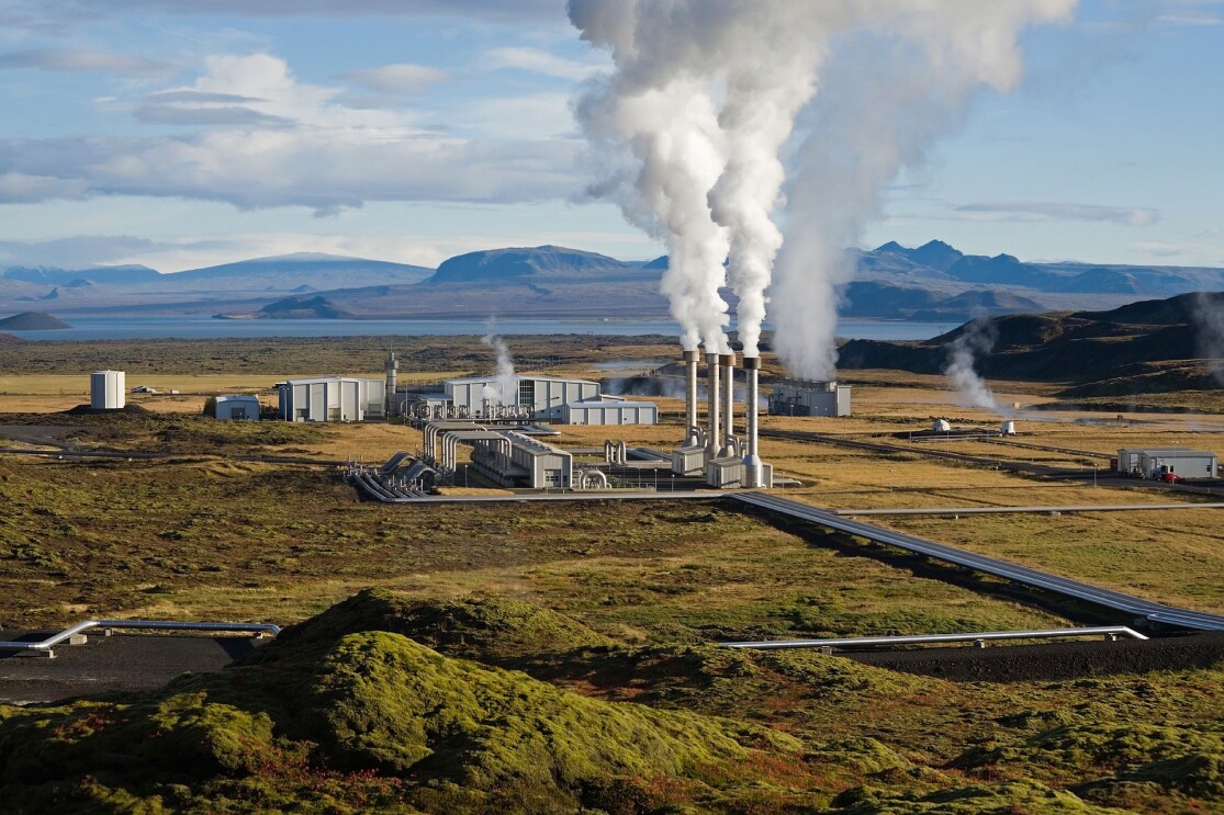
You’ll be able to spot the Nesjavellir geothermal power plant from a distance thanks to the white sulfur-scented steam rising from the massive metal pipes stretching across the site.
The Nesjavellir hike

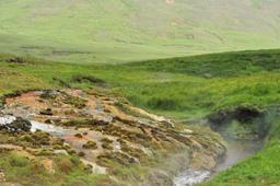
From the parking lots, signs clearly mark the start of the 8.5-kilometer loop trail. The path leads hikers through mossy lava fields, red hills, active fumaroles, steaming vents, and dramatic viewpoints over Lake Þingvallavatn.
As a loop trail, you can hike it in either direction, but the most scenic features are found on the southern side of the power plant. Many visitors choose to do only that section as an out-and-back hike. In comparison, the section near the power plant is less visually impressive.

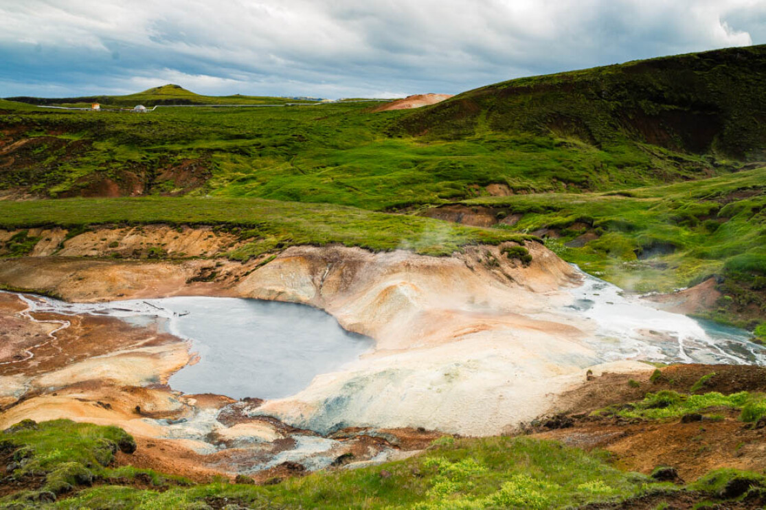
Even from the parking area, the view is spectacular, with a wide vista over Lake Þingvallavatn and its surroundings. About 1 km into the hike heading south, you'll encounter bubbling mud pots, solfataras, and steam vents—reminiscent of Iceland’s more famous geothermal sites like Seltun or Geysir.
From this vantage point, you’ll also see Hengill, a dormant volcano that towers over the region.
The trail is well-marked with yellow stakes topped in green and winds through moss-covered terrain before descending into the steaming heart of the geothermal zone, eventually reaching the power plant. Along the route are eight numbered viewpoints (1 through 8) that help you follow the path.
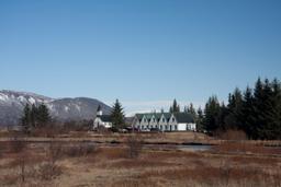
As you reach the power plant, the trail skirts along massive silver pipelines that crisscross the gravel landscape. Surprisingly, they blend quite naturally into the environment. After passing the power station, the trail approaches the ION Adventure Hotel. Just behind the hotel, the trail ascends back up through mossy hills to return to the parking areas.
The climb back is moderately steep in some spots but manageable, with an overall elevation gain of about 300 meters. Most hikers can complete the full loop in about two hours, and it’s doable for families with older children.
For those looking for a shorter outing, you can simply park at the southernmost lot and walk out and back along the scenic southern section of the trail. This option takes about 40 minutes round trip and still includes the area’s colorful geothermal features.
Where to stay

As mentioned above, the ION Adventure Hotel sits right in the middle of the geothermal zone. It offers high-end accommodations with a geothermal spa, a locally inspired restaurant, and rooms with panoramic views of the surrounding nature.
For budget travelers or camping fans, the Þingvellir campground is just a 15-minute drive away. Located near the lake, it offers simple yet clean and well-maintained camping facilities.