Snæfellsjökull Volcano, National Park, and Hiking Trails
Snæfellsjökull National Park is criss-crossed with hiking trails of every kind, each more beautiful than the last.
Some take you to quaint fishing villages along the coast, others to explore lava fields, while others venture out onto the mythical Icelandic glacier made famous by Jules Verne in his "Voyage to the Center of the Earth": the Snæfellsjökull, which culminates at 1448 m.
Snaefellsjökull National Park and its volcano

Map of Snæfellsjökull National Park - Boldair @wikipedia
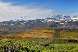
The majestic Snæfellsjökull volcano and its glacier dominate the West of the peninsula. This great volcano last erupted about 1800 years ago, but the oldest eruptions are dated about 8000 years ago. On a clear day this peak is visible for many miles, and from its summit you can even see the capital Reykjavik.
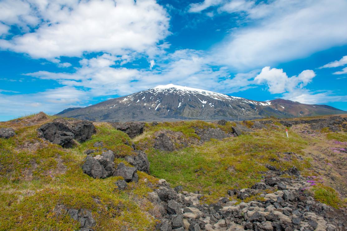
At the summit of Snaefellsjökull sits the glacier of the same name, covering the volcano with no less than 11 km² of ice.
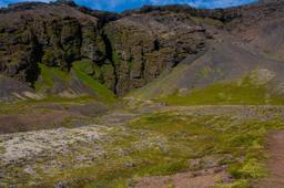
The Snæfellsjökull region was declared a National Park in 2001 and occupies the entire western tip of the peninsula, from Hellissandur in the north to Hellnar and Londrangar in the south. The stratovolcano rises from its very center like the bull's-eye of a target and occupies a large part of the park.
Snæfellsjökull's lava fields from past eruptions are carpeted in lush green mosses, and there is a rich biodiversity here with various marine animals, oysters, arctic terns, and murres, as well as a fairly large population of polar foxes.
For more information on Snaefellsnes, see our complete guide to Snaefellsnes
Snaefellsjökull National Park hikes

The Snæfellsjökull
The vast majority of hikes offered in the Snæfellsjökull National Park are conveniently listed on the document below, proposed by the Environmental Protection Agency of Iceland. No less than 35 hikes are featured, from the shortest 10-minute stroll to the 5-hour ascent of the mythical Snæfellsjökull glacier.
Here are our favorites:
Arnarstapi - Hellnar

From Arnarstapi to Hellnar
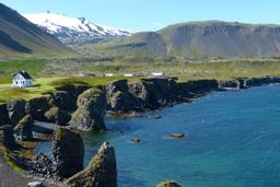
One of the best known hikes in the region is the magnificent trail from Arnarstapi to Hellnar in the south of the peninsula. Between the two villages is a large lava field named Hellnahraun. The Neðstagata trail runs along the coastal edge of this lava field, a landscape rich with birdlife.
Tridactyl terns and seagulls are thriving here, especially near Hellnar and Arnarstapi. This coastline, now a protected nature reserve, includes some truly unique rock formations. The cooled lava stands frozen in magnificent organic arches and caves which have become, over time, a perfect habitat for local birds.
It only takes an hour to hike the 5 km round trip (2.5 km x 2) and the walk is easygoing. If you are leaving from Arnarstapi, a halfway break in Hellnar at the local café is highly recommended to try their delicious cakes.
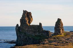
Svalthufa — Londrangar - Malarrif

Londrangar
A few kilometers west is another trail in the same style. Starting from the Lóndrangar car park, head towards Svalþúfa and on the way you may be lucky enough to spot Arctic foxes in addition to the numerous birds! The trail starts down the coast on the way to a moss field.
From the field keep going 600 m to reach Malarrif and its lighthouse for a total trail length of 2.6 clearly marked kilometers. On the way back, take a moment to admire the two superb basalt columns of Lóndrangar, true symbols of the region's landscapes.
The Ascent of Snaefellsjökull

Snaefellsjökull: Fyle @fotolia
A hike to the top of Snæfellsjökull takes approximately 3 to 5 hours, totalling an elevation of 760 m over 8 kilometers. The glacier ascent can be dangerous for those who are not used to hiking on the ice. Visitors are strongly advised to check the state of the roads and roads before leaving for this hike, and to be particularly careful.
Local tour companies offer guided excursions allowing you to scale the Snæfellsjökull in total safety.
As the summer progresses, the ice becomes more fickle, crevasses widen to the point of making the hike impassable. It takes about a day to ascend the glacier (return trip), however you can cut that distance by 4x4 via off-road trails from Arnarstapi and Olafsvik in the North, and trail 574. The ascent from the north (Olafsvik) is relatively simple but starts off with a very steep slope.
After this painful slope (a few hundred meters), you reach a plateau and the ascent becomes smoother. It is important to note that the trails to the summit are not really marked, so it is recommended that you bring a map. The view of the coast is already exceptional at this level.
Several small waterfalls will cascade down past you as you make your way to the summit. Most tourists prefer the (easier) ascent from Arnarstapi by driving part of the way up via the F570. Whichever way you go, from the top the view of the ice cap and lava fields is panoramic and truly astounding.

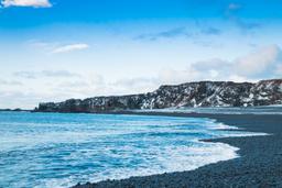
Hellissandur in the north-west of the national park: ©TTstudio @fotolia