Kjölur : the F35 track
The F35 track is one of the two main inland trails crossing Iceland from the Golden Circle to the northern coast. The trail starts from Gullfoss and run due north to Blonduós for about 200 km.
Even with no ford to cross this trail requires a 4x4 vehicle as it is an F trail, so be sure to have the green light from your rental company before you start on the F35. Another key preparation point before hitting the road is to check the road condition on Vegagerdin, updated several times a day.
The F35 into the highland deserts
Historically, the F35 Kjolur trail was in fact used as early as the year 1000 by northern Vikings to reach the Golden Circle and in particular the Thingvellir parliament.
Don't expect to encounter villages or even inhabitants along this trail. This is a desert. There is literally nothing there, not even a gas station, so be sure to leave with a full tank when you start this journey. The trail itself is very rocky in places, but you can be sure it won't be crowded! While the trail never gets to really technical levels, it is slow going and you should not expect to exceed 40 km/h.
Not to mention the various stops... It will still take 4 to 5 hours to get from Gullfoss to Blonduos in the north, but it is one of the most beautiful trails in the highlands, and you will be taking photo breaks all the time.

Shortly after Gullfoss, the asphalt gives way to dirt, stones, and some quite large potholes. Vegetation is then much rarer out here, and the magnificent barren landscape gives a real sense of being alone in the world.
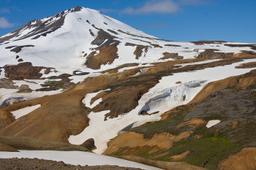
The trail passes between two of the most important glaciers on the island: the Langjökull Glacier and Hofsjökull, but these are usually just part of the background as visitors usually take this trail to reach the Kerlingarfjöll Mountains.
Things to see along the Kjölur

The trail takes us past the black volcano Bláfell, then back down to the Hvitá valley that feeds the famous Gullfoss waterfall.
Lake Hvitárvatn
Lake Hvitárvatn (30 km²) is one of the largest glaciers in the country, located at the foot of Langjökull.
A short detour by exiting the F346 on the left will lead to the lake. Less than 50 km from Gullfoss, the lake is well known for its milky appearance due to the minerals carried by the Langjökull ice, and the contrast with the black sand that surrounds the lake is magnificent.
Some specialists offer glacier tours, which are superb on a clear day.
Continuing on the F35, the vegetation becomes more and more sparse, giving way to cairns in the heart of the highland desert.
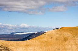
Kerlingarfjöll and its hiking trails
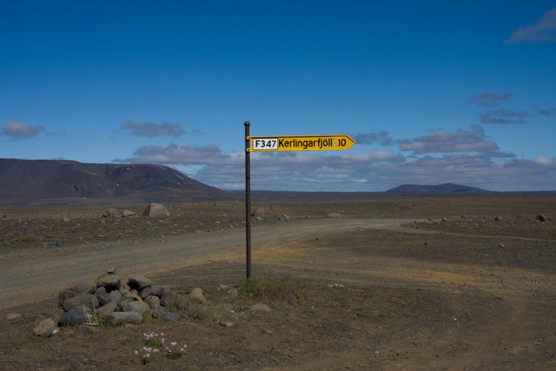
About fifty kilometers further, you can reach the F347 trail, famous for leading to one of the most magical places on the island: Kerlingarfjöll.
For many, it is simply the most beautiful place to see in Iceland.
The hills of yellow and ocher rhyolites contrast with the white snow and black ash. Hiking trails are countless and there are shelters for travelers wishing to trek one or more nights in the wild.
Just after the junction between the F347 and the F35 is Gýgjarfoss, a gorgeous waterfall worth the detour before heading up to the Kerlingarfjöll mountains.
The hikes offered in Kerlingarfjöll range from short 1-2 hour hikes to full-day hikes. Hiking is a great way to take in the scenery, and this place has a lot of scenery to offer.
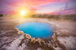
The Hveravellir oasis
The F35 is the trail to another essential stop on the road to the North: Hveravellir. This geothermal site famous for its mud pots, fumaroles, and hot springs is a great place to relax and there are camping grounds and shelters available.
Many tourists stop at Hveravellir to take a break from all the hiking by swimming in the 38 °C turquoise water with healing minerals. A delight you won't soon forget!