Thórsmörk: Hiking Trails and Panoramic Views
Very popular with locals for their own holidays, Thórsmörk (Þórsmörk or literally: “Thór's Woods”) is a glacial valley located between the Eyjafjallajökull glaciers in the south, Tindfjallajökull in the north, and the imposing Mýrdalsjökull in the east.
Surrounded by rolling hills and dense birch forests, the Thórsmörk Valley is renowned for the endlessly surprising palette of colors, in particular the vivid green and yellow mosses of its mountains.
- Thórsmork: an exceptional panorama
- How to get to Thórsmork
- Thórsmork hiking trails
- Accommodation in Thórsmork
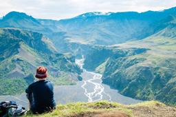
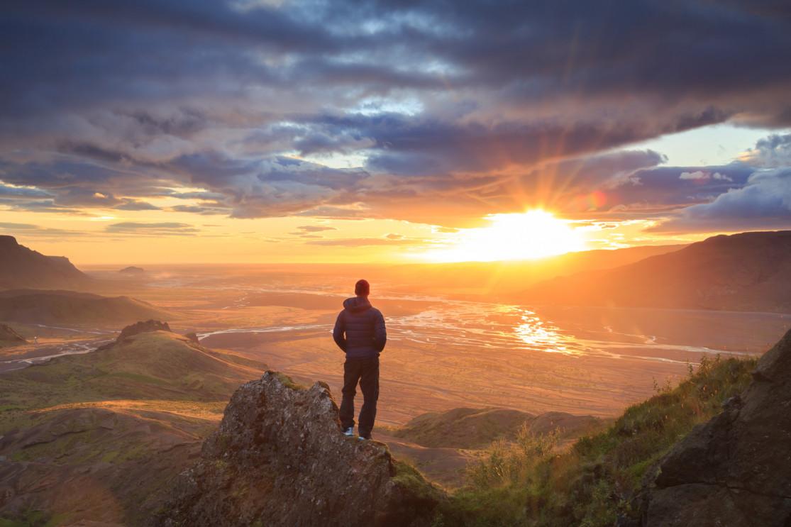
Thórsmork: an exceptional panorama

Thórsmörk and the landscape - Robby McCullough @Unsplash
In the valleys where microclimates are protected by the mountains, there is an astonishing richness of mosses, ferns, and birches. The local climate is very mild, with more sunshine than the rest of South Iceland.
Þórsmörk stretches east-west, bounded in the south by the Krossá valley, in the north by Þrönga and the Markarfljót, in the west where the Krossá meets the Markarfljót, and in the east by the imposing mountain range of the Mýrdalsjökull.
The small peaks that form this relief have their flanks cut by numerous small valleys. The highest point is Tindfjöll.
The panoramas found there are some of the most beautiful that can be found in Iceland, the climate allowing forest, moss, and stone to contrasts with bright icy white, and the 360° viewpoints are simply endless.
How to get to Thorsmork?
Located about 150 kilometers from Reykjavík, Þórsmörk is without a doubt one of the most difficult sites to get to in Iceland by car. You'll need a capable all-terrain vehicle to visit Þórsmörk, 4x4 or not at all!
There are 3 ways to get to Thórsmörk: driving a rental 4x4 on your own, by bus and finally with a full guided tour (superjeep or 4x4 bus).
Driving to Thórsmörk by 4x4
In a basic 4x4 rental, it can be a challenge to get to there, conditions have to be perfect. Departing from Seljalandsfoss, take the F249 and you'll see that while smooth at first, near the meandering Markarfljot things get very rough indeed. There are many deep fords to cross along the F249 (see video at the bottom of the page).
The Krossa ford in particular is considered one of the most dangerous in Iceland and without a raised and fully-kitted 4x4, to risk crossing it would be very reckless.
Keep in mind that from autumn to late spring the Thorsmork Valley is almost inaccessible, the only way to get there outside of summer is a super jeep.
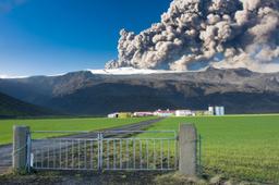
It takes about 1 hour of travel on the F249 to Thórsmork. But along the way, the Gigjökull glacial tongue is the perfect place for a break to stretch your legs. In mid-April 2010, it was through Gígjökull that part of the meltwater from Eyjafjallajökull escaped during the second eruptive phase of the world-famous eruption.
The safest option is to park near the glacial tongue of Gigjokull or even at Seljalandsfoss to then take a 4x4 bus to "Thor's Woods", as the fords on the way to Thorsmörk are often deep and difficult to cross.
Let's be clear: unless you are a skilled off-road driver with the right car, this is probably the most reasonable solution.
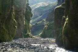
Getting to Thórsmörk by bus

Thórsmörk Canyon - Martin M303 @fotolia
Between June 10 and September 15, there is a daily bus from Reykjavík to Thorsmörk. It makes several stops at Hveragerði, Hella, Selfoss, Hvolsvöllur and finally the Seljalandsfoss waterfall car park.
So you can take the bus from any one of these stops in the morning, and catch the return bus in the evening (or the next day for those who want to spend the night there). Additional information and bus times on the IcelandByBus website
Most park their vehicles in Seljalandsfoss and take the bus directly from the waterfall parking lot. It takes 1 to 1h30 by bus to reach Thorsmörk from the waterfall depending on where you want to stop: Básar or the Húsadalur Volcano Huts.
Buses and other organized super jeeps stop near the huts, such as at the Stakkholtsgjá Canyon or Skaggsfjörskalli.
Go to Thórsmörk via an organized day trip
To reach the valley, many tourists choose to book an excursion with tour companies who offers day trips via super jeep, for example:
- Full day tour of Thorsmork by Super Jeep from Hvollsvöllur
- Full day tour of Thorsmork by Super Jeep from Reykjavík
Thorsmörk hikes

Map of Þórsmörk
Numerous hiking trails await you in these mountains, and Þórsmörk is the starting point of Iceland's most famous trek. For additional details:
The “Laugavegur” Trek: Landmannalaugar — Thórsmörk. This 4-day trek is about 55 km long along an official circuit:
- Stage 1: Landmannalaugar, Hrafntinnusker (10 km)
- Stage 2: Hrafntinnusker, Álftavatn (11 km)
- Stage 3: Álftavatn, Emstrur (16 km)
- Stage 4: Emstrur and Þórsmörk (13.5 km)
Many hikers add another day to the mix and go as far south as Skogar.
The two best known and most popular hiking trails in Thórsmörk are described below:
The Thorsmörk Panorama Trail 4.5 km - 1.5 hours

Of the countless hikes that leave from the Langidalur refuge, this gem begins with an ascent of Valahnúkur, which is a must-see. The magnificent view of the nearby glaciers is worth it: this is the Húsadalur viewpoint and it truly is exceptional.
From the Volcano Huts, it takes about 1.5 hours to complete the 4.5 km loop to the summit, and the circuit is called the “Þórsmörk Panorama Trail”. All you need to know about the Valahnúkur hike.
The Thorsmörk Highlights 9.5 km hike - 3H30
This is probably the best hike in Thórsmörk. All the best viewpoints in Thórsmörk lie along this hike. The trail takes you down the Laugavegur hike through the birch woods of the Húsadalur Valley and into the foothills of the Tindfjöll Mountains.
From there, you can choose to go down Thórsmörk Valley along the Slyppugilshryggur ridge, or take the trail that runs through the Slyppugil Canyon.
At the bottom of the valley you'll find the Langidalur refuge. From there, you have to climb to the top of Valahnúkur for a sensational panoramic view before going back down to the Volcano Huts.
On site you can also go to Songhellir, the “cave of songs”: legend has it that when the wind picks up, you can hear the dwarves singing.
The many short hiking trails in this magical place are listed on the VolcanoHuts site.
The Tindfjöll Circle Hiking Trail 9.5 km hike - 3H30
An unforgettable hike that goes around Tindfjöll and offers the best viewpoints of Thórsmörk.
You can start the hike from either:
- Husadalur (13.5 km)
- Langidalur (9.5 km)
All you need to know about Tindfjöll Circle.
Accommodation: sleep in Þórsmörk

The views over Thórsmörk - sanderstock @fotolia
There is a campsite just where you get off the bus, the Volcano Huts campsite, which has an excellent reputation and offers a variety of types of accommodation: from tent encampments to glamping to furnished huts.
Volcano Huts also has a small restaurant - bar where you can eat and enjoy a drink. Learn more about Volcano Huts on booking.com.
Despite being so hard to get to, the Thorsmörk valley is probably one of the country's unmissable sites as its beauty truly is in a league of its own. You won't forget it.