The Leirhnjukur Hiking Trail
Krafla is not just one, but a system of volcanoes located in the Myvatn region of Northern Iceland, which is one of the most active volcanic zones in the world. If you came to Iceland to see volcanoes, this is the place to be!
Find out more about the Lake Myvatn region in our dedicated article. This area is a veritable treasure trove of geological phenomena.
What are Leirhnjukur and Krafla?

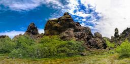
Leirhnjúkur is one of the volcanoes in the Krafla volcanic system. Krafla has a reputation for being volatile and dangerous. From 1724 and 1729 the region suffered successive eruptions, and then another series more recently and this time with earthquakes from 1975 to 1984.
The fissures left by the Leirhnjúkur volcano extend for nearly 20 kilometers, some lava flow still hot in places many decades after the last events. Leirhnjúkur is right in the center of the Krafla caldera, and was hit the hardest and the longest during the volcanoe's many eruptions.
How to get to Leirhnjúkur
It takes 1 hour to reach Lake Myvatn where the volcano is located from Akureyri, the nearest town. The Leirhnjúkur car park is located north of Lake Myvatn, along Road 863 a little beyond the Kröflustöð geothermal power station. Take a left after the power plant, following signs to “Krafla/Viti”. This car park is the departure point for the popular hike.
At the car park you'll find a map of the hike and information board, and there are also toilets.
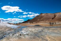
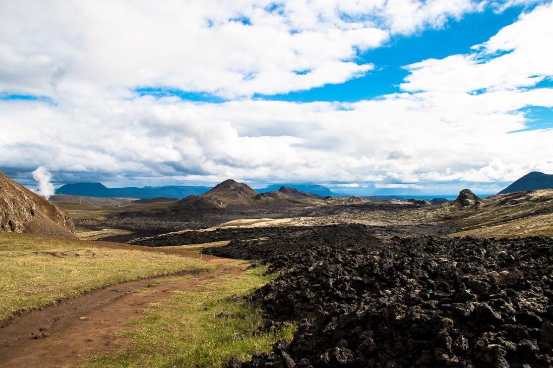
A hiking trail in a lunar landscape

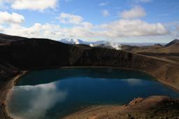
From the car park you'll find the start of the trail, a path that cuts between a vast field of smoking black lava on the left and Krafla on the right, and the small but no less famous Lake Víti a little further on ahead of you. The Víti crater formed during the eruption of 1724 and has since filled with turquoise blue water that contrasts beautifully with the other orange/black flanks of the cone.
There are 2 hikes to choose from, a small loop you can wrap up in 1H and a big loop in 1H45. The trail is very family-friendly with almost no elevation. The path is laid out and there is no "hors piste" here in Krafla, you do not stray from the path as the lava is still very hot in places. The trail takes you across green landscape of mosses (thufurs formed by frost and thaw) before returning to the meat of the matter, lava flows and volcanic stone, dramatic and striking tones. Solfatars and fumaroles belch smoke and sulfur constantly, while bubbling pools of mud hiss and spit into the air.
It's almost supernatural, like another planet you discover gradually at first. The green of the moss near the car park gives way to the gray of the old lava flows, and then to the jet black of the more recent hot flows. This is without a doubt one of the most incredible short hikes in Iceland.
Ocher and yellow patches decorate the stone, sulfur yellow to be precise, and the earth is cracked and scarred. Both long and short hiking trails are absolutely magnificent.
Stay on the right side of the marked path to reach the Hofur crater after about 30 minutes on foot. Then it's another 30 minutes to climb to the top of Leirhnjúkur, which offers an unforgettable panorama of the entire caldera over ten kilometers.
The hike is short but is absolutely a must-see in the Myvatn region.