The Hekla Volcano
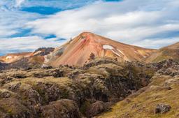
The Hekla volcano is one of the most famous in Iceland. Located 150 km from Reykjavík in the Thjórsárdalur valley, Hekla dominates the region from an altitude of 1491 meters. It is a national emblem and one of the most active volcanoes in the country.
Hekla literally means “cape” or “hood” in the old Viking language, likely due to the fact that it is often covered by clouds.
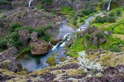
You can't miss Hekla when you pass through the region, towering just at the entrance of the Fjallabak Nature Reserve. This monument dominates the desert landscape that it shaped over numerous past eruptions. Hekla has a singular appearance, being shaped like a “capsized boat”.
The volcano has a dark and mysterious side, the summit often cloaked in clouds like a constant threat. The summit of Hekla is snow-capped all year round and altogether the site is imposing and awe-inspiring.
Hekla is part of a volcanic chain that extends for nearly 40 km and includes a volcanic fissure called Heklugjá totalling 5.5 km long. It is this crack, the most active, that is considered the epicenter of Hekla stratovolcano's activity.
A stratovolcano is an explosive volcano that can project deadly debris and lava.
Hekla is quite young for a volcano, formed “only” 7,000 years ago, and is the stuff of legend: local lore suggests that Hekla is nothing less than the gateway to the Underworld.
Hekla: one of the most dangerous volcanoes in Iceland

To locals, Hekla is one of the scariest volcanoes in Iceland. It is one of the most active, with no less than 20 eruptions since the year 874. Its eruptions are violent and especially difficult to predict, which is the worst combination you could imagine. Indeed, during the most recent eruptions the tremors were only felt at the last minute, literally 30 minutes before the eruption!
Hekla has devastated Iceland so many times that in fact 10% of the tephras generated over the last millennium in Iceland come from its eruptions. Hekla is also one of the largest lava producers in the world during this same period, generating 8 km³ of lava.
Icelanders are very wary of this region as in the past Hekla's eruptions have been devastating. Especially in 1104 when its eruption covered half of the country with tephras! And in 1300 when Hekla erupted again, it lasted an entire year and caused 500 deaths in the country.
More recently, in 1947, Hekla's eruption left a rather lasting mark. Its explosion could be heard all over the country and the mushroom cloud of vapour it created rose 30 km into the ski. The volcano propelled 20 kg projections at distances over 30 km! Ashes from the eruption were even found as far as Finland, 3,000 km from the stratovolcano...
The year 2000 marked the latest eruption in Hekla's career, lasting only a week but produced large lava fountains and the vapors and ash formed a cloud 11 km high.
The question is not if, but when Hekla will erupt again...
Hike: The ascent of Hekla
A 4x4 vehicle is required to get to Hekla. After taking road 26, turn off on the F225, one of the most beautiful tracks in Iceland, for about 10 kilometers. An unnumbered track then goes down to the right in the direction of the volcano.
Follow this very bumpy track for 7 or 8 km to the Rauðaskál car park. With a rented 4x4, it is not recommended to continue the track any further.
Because of the unpredictable nature of the Hekla volcano, it's a pretty bad idea to attempt the ascent alone. As you arrive on site, a sign clearly states this is a dangerous volcano and asks all hikers to download the “112Iceland” application, the system used to communicates real-time information in the event of an imminent eruption.
If this should happen, messages are sent to all mobile phones located near the volcano, and you must then call 112 once you are a safe distance from the volcano so they know you are safe. If you want to hike alone on the volcano, it is strongly recommended that you only go there when all conditions are perfect.
The site also features a webcam observing Hekla's behavior in real time.
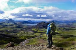
The hike is not very long, a return trip of 10 km in total, so a total of 3 to 4 hours. The view from the top of the volcano is breathtaking and you will immediately see how the Hekla lava flows ravaged the landscape, radiating outward from your viewpoing at the summit.
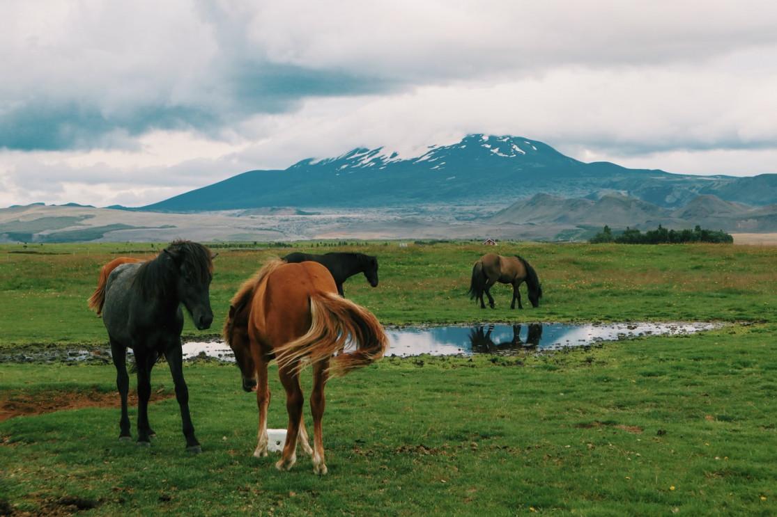
From above, we have perhaps the most beautiful 360° view in the country with Vatnajökull, Myrdalsjökull, Langjökull, and Hofsjökull, Iceland's four largest glaciers, standing proud on the horizon. Looking East, there is also a breathtaking view of Landmannalaugar in the distance and the ocean to the South. Altogether incredible scenery.
The vast majority of hikers who ascend Hekla are accompanied by a guide and get to the trail by Super Jeep, which is much safer when you want to climb an active and unpredictable volcano like this one.