The Laugahraun Hiking Trail
Located in Landmannalaugar, Laugahraun, literally “the hot spring lava flow” to locals, is (you guessed it) a lava flow extending from Brennisteinsalda to the Vondugil valley.
Laugahraun is also the name of an official hiking trail in Landmannalaugar, the easiest and most recommended for families with young children. The hike takes you through this uniquely picturesque lava field.
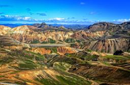
The Landmannalaugar region is one of the most famous in Iceland both for the incredible richness of its panoramas but also, and above all, for being one of the best places for hiking.
- How to get to the starting point of the Laugahraun hike?
- Landmannalaugar: a hiking paradise
- Laugahraun: hike across the lava field
How to get to the starting point of the hike

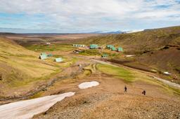
The starting point of the hike is at the Landmannalaugar campsite car park. Landmannalaugar is located in the central highlands, accessible only with planning and effort, and pretty much only in summer.
There are several ways to get there, but the simplest and most direct is the mythical F225 track, which includes several fords but has the reputation of being one of the most beautiful trails in the country (4x4 mandatory). The next option is Road 208, preferred by most tourists because its access from the North is relatively simple, without fords.
Technically, some roads there wouldn't require a 4x4, but it is still mandatory for safety reasons.
Other options include the bus network, and the side is well served by local companies (BSI...).
There are also day-trips to Landmannalaugar with fully guided excursions, or superjeep tours with a shuttle from Reykjavík to Landmannalaugar and back:
- Day trip all year round to Landmannalaugar
- Landmannalaugar and Hekla Superjeep Day Trip
- Landmannalaugar Superjeep Day Trip
Landmannalaugar: a hiking paradise

The Landmannalaugar region is a wonderland of natural attractions, full of exceptional sites, as covered in our guide:
This is also the start (or end!) point of the most famous hike in the country:
When you arrive at the car park there are almost too many hikes to choose from! The decision is often based on the difficulty of the trail and the time required to complete it and get back.
The Laugahraun - Brennisteinsalda - Graenagil hike is probably the easiest of the various trails departing from the car park. It is accessible to everyone, even children, and can be wrapped up in about 2 hours for a distance between 4.5 and 6.5 km depending on the variant chosen.
Laugahraun: a hike across the lava field

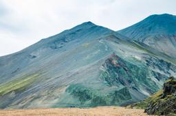
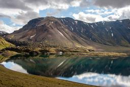
At the car park you'll see the sign indicating the hike starts behind the cabins heading west. The trail climbs a little until you reach a first plateau in the middle of an impressive lava field with a breathtaking view of the Brennisteinsalda and Bláhnúkur.
The trail is very well-marked, and the scenery is magical, the black of the lava fields in sharp contrast against the green moss that covers them. The hike goes on towards the Vondugil valley with its rhyolite rocks. From the campsite all the way to the valley, the hike remains very simple with few difficult climbs.
From this point on, there are two options:
- Climb Brennisteinsalda
- Pass by the foot of Brennisteinsalda
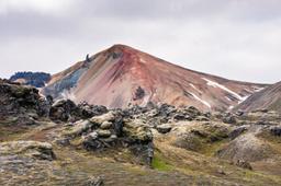
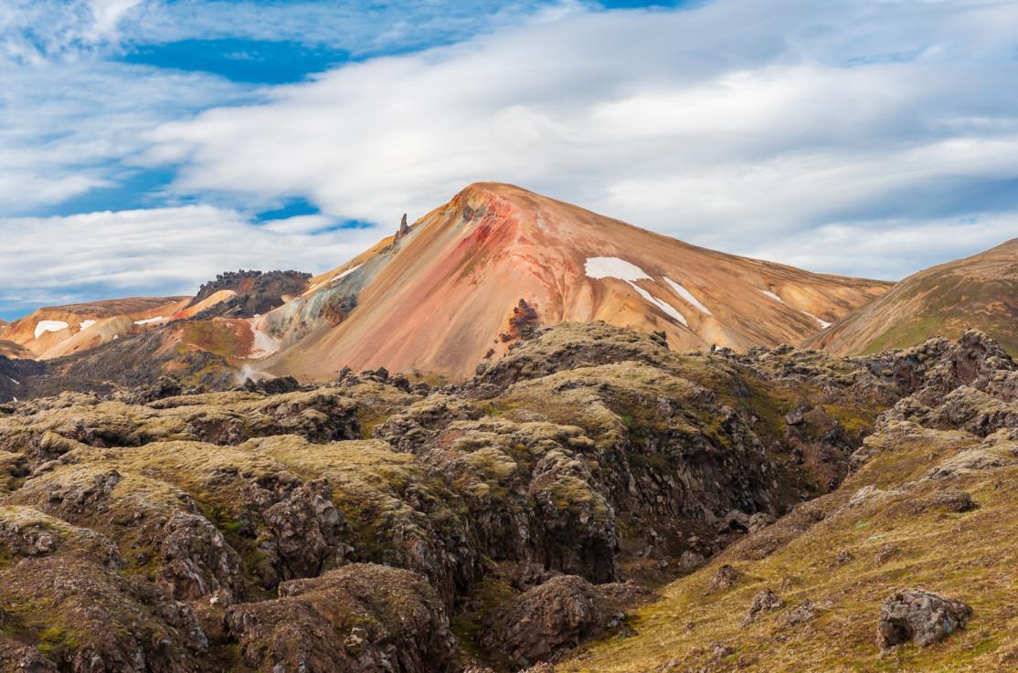
The official 4.5 km hike (#1) takes the second option. Just follow the trail up towards the fumaroles at the foot of the red and orange Breinnisteinsalda mountain.
Laugahraun is the simplest official hiking trail and recommended for families with young children, known for being easygoing with little elevation.
Kids are always impressed by this lunar landscape misted with sulfur and smoke, before continuing across another lava field that leads to the Graenagil valley at the foot of the famous Bláhnúkur mountain. The trail gets a bit rocky on the way up to Graenagil before smoothing out along the banks of the stream on the way back to the car park.
Here, the ocher tones of Brennisteinsalda give way to the grey-green flanks of Graenagil.

If you choose option one, the ascent, you need a good hour more to climb Brennisteinsalda and about 2 km, but the view is exceptional and definitely worth the detour.
Whatever variant you choose, the Laugahraun trail is a fantastic way to discover the Landmannalaugar region, even if all you have is a half a day on site. The views are striking and allows you to discover many facets of Landmannalaugar.
And if you have the stamina, you can keep it going with the extended hike ascending the famous Bláhnúkur, just keep in mind this detour adds about 3 km more and a rather steep climb.