The Brennisteinsalda Hiking Trail
Brennisteinsalda is a volcano located in the Landmannalaugar region, famous for its ascent, a beautiful hiking trail.
Landmannalaugar is a hiker's paradise, and the Brennisteinsalda hike is arguably the top choice in the region, along with Bláhnúkur.
How and when to go to Brennisteinsalda?

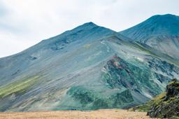
Brennisteinsalda and its fumaroles seen from Bláhnúkur
To hike the Brennisteinsalda trail, you'll have to go off the beaten track and into the Highlands, to Landmannalaugar. Travel tips and itineraries for Landmannalaugar can be found in our dedicated Landmannalaugar guide.
Although isolated, the region is not the hardest place to get to in Iceland, but you will need a 4x4 or SUV vehicle to get there. The easiest way to reach Landmannalaugar is via Road 208 from the north.
The road is closed in winter, accessible between June and September, but the rest of the year you can visit via group excursions with tour companies who drive you there in prepared off-road vehicles:
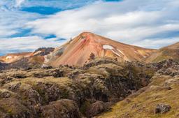
Brennisteinsalda mountain

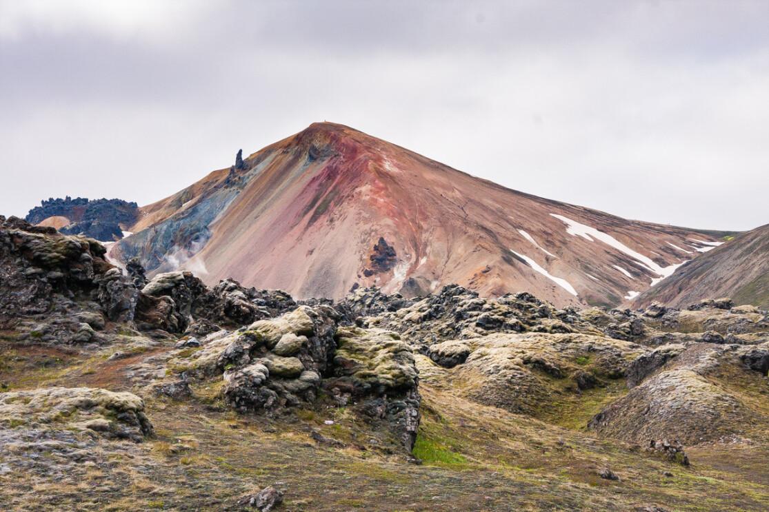
The orange-red sides of Brennisteinsalda
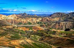
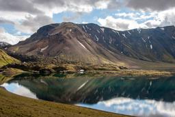
Landmannalaugar is famous for its colorful mountains and unique panoramas. When you arrive near the Landmannalaugar car park, the first thing you notice is two peaks: the first, dark and imposing with its 943 meters of altitude, is the Bláhnúkur. Its neighbor is just as impressive and immediately stands out with its red and yellow flanks: the Brennisteinsalda, culminating at 881 meters. Both are part of the Torfajökull volcanic system.
The red color comes from iron and the yellow from sulphides, the black and blue due to lava and the vivid green of lichens.
Its name literally means "sulphur wave" (in Icelandic, "brenna-steins-alda" means burn-stones-wave). In addition to these exceptional colors, it can be spotted from afar thanks to the solfatars that spout gouts of smoke. But don't worry, while the Brennisteinsalda is indeed a volcano its last eruption dates back to the year 1341.
For the brave hikers who make the famous Laugavegur, the first part of this famous trek from Landmannalaugar to Thórsmörk passes alongside this mountain.
The Brennisteinsalda hike

The route of the Brennisteinsalda hike
The Brennisteinsalda hike is easier than the Bláhnúkur hike and takes about 2.5 hours, a little less for the more athletic to complete the 6 km loop from the car park.
Many hikers combine this hike with the Bláhnúkur hike for a total of 4.5 hours of hiking, or just under 10 km.
Hiking through the lava fields

Vondugil and Haalda
From the parking lot, follow the sign West via the trail that starts behind the cabins. It's a bit of a climb until you reach a first plateau of an impressive lava field with a breathtaking view of Brennisteinsalda and Bláhnúkur.
The trail is very well-marked, so you can just focus on the beautiful landscape. The black of the lava fields stands in vivid contrast with the green of the carpet of moss. Next up is the Vondugil valley, where the rhyolite rocks jut from the ground, a formation estimated around the year 1477. It's an easy level hike with little elevation from the campsite to the valley.
Among the solfatars

Brennisteinsalda fumaroles
Keep following the "Laugavegur" trail (red stakes/pegs). After two rather easygoing kilometers, you arrive at the foot of Brennisteinsalda with its red flanks and sulfurous air. Turn right and begin the ascent of the volcano for 1.5 km, following the green stakes this time.
During the ascent, you may notice a curious rock in the shape of a horn. Legend has it this astonishing rock is in fact a troll petrified by the sunlight.
The summit boasts a stunning view over the Laugahraun lava fields, the Vondugil valley and the Landmannalagar campsite in the distance as well. The great Bláhnúkur looms very close and is a sight to behold.

Hikers leave Brennisteinsalda to reach Graenagil
Follow the trail to the foot of Brennisteinsalda and its fumaroles before taking the eastern portion of the loop to the foot of Bláhnúkur and, if you so choose, continue the hike to ascend Bláhnúkur.
If you choose to do only the Brennisteinsalda part of the loop, follow signs to Graenagil across the lava fields for about 1 km over rough terrain but without elevation. Follow the small stream until you find yourself in the Graenagil gorge. The orange-red of Brennisteinsalda gives way to the improbable gray-green of Graenagil as you hike this rocky path.
Graenagil Gorge

The green sides of Graenagil
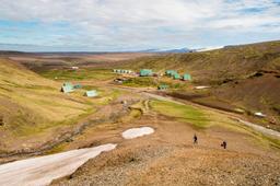
From this stunning gorge it's just a few hundred meters to the Landmannalaugar campsite where you can soak your weary feet in the hot water river!