The Eldgjá Rift
In southern Landmannalaugar, just 20 km north of the famous Laki crater lies Eldgjá, literally “the Gorge of Fire”, the largest eruptive fracture in the world.
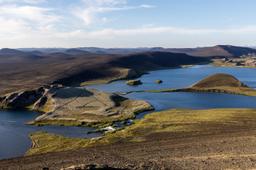
Stretching over 40 km from the huge Myrdalsjökull glacier up to the famous Vatnajokull, this rift lies north-east of the Skafta River and belongs to the Katla volcanic chain.
Eldgjá: a Massive Volcanic Rift

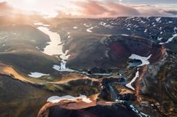
In the heart of this rift lies the Eldgjá, an 8 km long canyon into which rushes the Norðari-Ófæra river to give us the spectacular Ófærufoss waterfall. In layman's terms, this canyon resulted when the terrain collapsed over an area 600 m wide and 140 m deep on average, in some areas plunging 270 m.
The gigantic fissure appeared during the eruption of the Katla volcanic system in 934 releasing nearly 18 km³ of lava. To this day one can see lava flows lining the bottom of the canyon, though most of those in Eldgjá were covered years later by the lava flowing out of Lakagigar (Laki) during another of the country's frequent eruptions.
What to do on site

At the heart of the rift
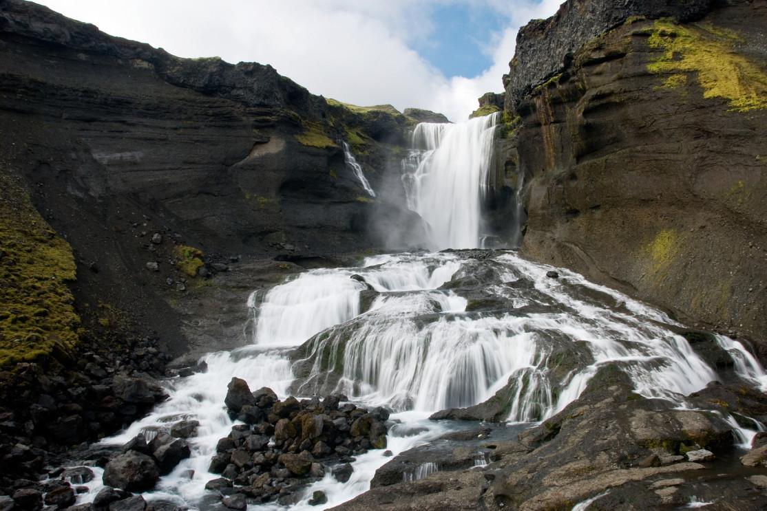
Besides the canyon itself, you really shouldn't miss the Ófærufoss waterfall, a superb multi-level cascade thundering in the middle of this devastated landscape. This waterfall was famous for the colossal arch connecting the two upper banks until in 1992 this natural feature suddenly collapsed.
It was a truly beautiful sight, but also critically provided a path for visitors to pass from one side of the rift to the other, a convenience almost too good to be true. A photo of the arch dated 1991 is free to view on the PhotoVoyage website.
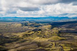
On site there are numerous hiking trails departing from the car park. You can even descend into the canyon and see the fault from within, with its craters and gorges that are much more impressive up close. But you can't beat the view from the top staring right down the barrel of the canyon.

Ófærufoss Eldgjá waterfall: ©lenpri - Fotolia.com
From the car park, most visitors take the trail that leads to the Ófærufoss waterfall and gives you the most complete view for the least effort, a short 2 km hike to the waterfall.
Those with more stamina can keep going by climbing to the summit of Gjátindur (see map above) reaching an altitude of 943 m with a splendid view of the canyon in good weather. The hike to Gjátindur in total extends for 7 km.
How to get to Eldgja?
First and foremost, the Eldgjá site is not easy to get to, only accessible with an off-road 4x4, and exclusively in summer. Three alternative access routes get you to the car park:
- Northwards via the F232-233 trail that runs along the Myrdalsjökull glacier
- Northwards from Vik via the F208
- Southwards from Landmannalaugar via the F208
The F232-233 is probably the roughest and least used route, but the F208 while easier remains a bit of a challenge from coming from the north. The F208 trail is magnificent but will cross numerous fords between Landmannalaugar and Eldgjá, requiring a good hour to drive the 35 km that separate the two car parks.
That's why most visitors take the F208 northwards, from Kirkjubaejarklaustur or Vik. From Road number 1 it takes just under 1 hour to complete the 50 kilometers. The trail is smoother and there is only one serious ford to cross just as you get to the site.
After turning off Road number 1 in the direction of the 208, the dirt road is in top condition for 16 km before you reach the F208 track. Then things get a little more rugged for 24 km, after which you branch off onto the small 5 km track that gets you to the Eldgjá car park.