The F208 Mountain Road

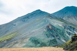
Located in the heart of Iceland’s Highlands, the F208 track, also known as Fjallabaksleið Nyrðri, is one of the country’s most iconic mountain roads. It winds through unforgettable landscapes—lava fields, rhyolite mountains, and endless stretches of black sand desert.
More than just a road, the F208 is a legendary driving route, offering a fully immersive experience in the raw and rugged beauty of the Icelandic Highlands.
- The F208 Track
- The Northern F208 between Sigalda and Landmannalaugar
- The Southern F208 from Vik to Landmannalaugar
- Accessibility of the F208
- Where to Stay Near the F208
The F208 Track

Best known as the gateway to the spectacular Landmannalaugar region, the F208 is widely considered one of the most scenic drives in Iceland.
As an “F-road” (short for fjallvegur, meaning mountain road), the F208 is open only to 4x4 vehicles and typically accessible only during summer —usually from late June through early September. The track stretches roughly 100 km, connecting Route 1 between Kirkjubæjarklaustur and Vík in the south to Hrauneyjar in the Highlands.
The route is divided into two main sections:
- The northern F208 is more accessible and smoother to drive.
- The southern F208 is wilder, more remote, and more technically challenging.

Technically, Route 208 begins near Hrauneyjar at its junction with Route 26. For the first 25 km toward Landmannalaugar, it’s a gravel road and not classified as an F-road. It becomes the F208 only shortly before Landmannalaugar and remains so until it rejoins Route 1 in the south.
Plan for at least 3 hours to drive the full 100-km stretch of the F208.
The Northern F208 between Sigalda and Landmannalaugar

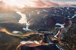
Frostastaðavatn along the F208 approaching Landmannalaugar
Coming from the north via Route 26, the road remains paved until Lake Krókslón near the Sigöldustöð hydroelectric station. From there, it turns into a gravel track, though still manageable for standard vehicles.

This northern stretch has no river crossings and is generally considered easy to drive.
Along the way, you’ll pass the striking Sigöldugljúfur canyon, also known as the Valley of Tears. Roughly 10 km further, the terrain begins to shift—the road turns black and sandy as you officially enter the Fjallabak region.

Expect a bumpy ride in parts, with the road feeling almost like cobblestones under your tires. But as you approach Landmannalaugar, the views become increasingly dramatic. You'll see stark black terrain set against vivid green moss-covered hills.
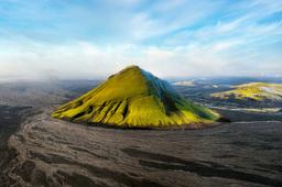
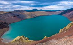
Must-see stops along this section include:
- Hnausapollur
- Ljótipollur
- Frostastaðavatn
- Stútur crater
Just after the Stútur crater, you can either turn onto the F224 to reach the Landmannalaugar campsite, or continue south on the F208.
The Southern F208 from Vik to Landmannalaugar

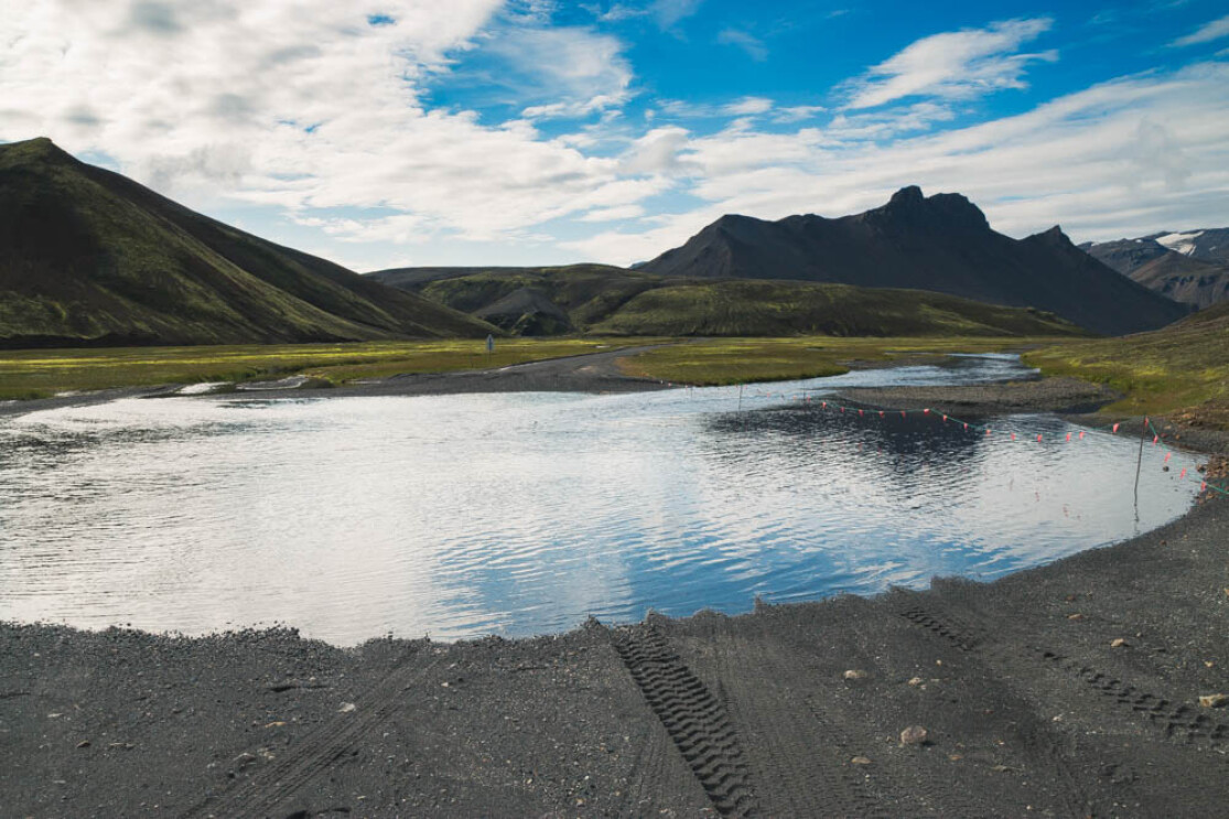
The southern portion of the F208 is more demanding than the northern section, with about 10 river crossings in total—though most are fairly shallow and easy to navigate.
Still, this section is widely regarded as the most beautiful part of the route, offering unforgettable views from start to finish.

Beginning at the junction with F224 near Landmannalaugar, the southern F208 runs just over 70 km until it reconnects with Route 1. It takes roughly 1 hour and 45 minutes to drive.
The road surface is mostly dirt, with only a few rocky areas. Between the Landmannalaugar campsite and the F235 turnoff (toward the stunning Langisjór), you’ll encounter around eight shallow river crossings, none usually deeper than 30 cm.

One of the many river crossings on the southern F208
Most rental 4x4s and SUVs will have no trouble managing the F208 trail. Only one river crossing represents a challenge for drivers: it’s one of the two river fords on the final stretch between the F235 junction and Route 1, near Eldgjá. This crossing is more intimidating because it’s longer and slightly deeper than the others.
While slightly more intimidating, this ford is still manageable with a standard 4x4 SUV like a Dacia Duster—as long as you follow the orange guideposts carefully (see below).
Accessibility of the F208
The F208 is only open during the summer months unless you're traveling with an organized tour. It usually becomes accessible from late June to early September, depending on weather conditions and snowmelt.
Before heading out, it’s important to check road.is for current road conditions and safetravel.is for safety updates and advice.
River crossings are one of the main challenges on this route. It's essential to know how to approach them: assess the water depth, observe how other vehicles cross, and drive through slowly without stopping.
Organized excursions
Many travelers choose guided excursions to Landmannalaugar to avoid the challenges of driving and to visit outside the summer season. A few popular options include:
- Day trip all year round to Landmannalaugar
- Landmannalaugar and Hekla Superjeep Day Trip
- Landmannalaugar Superjeep Day Trip
Where to Stay Near the F208

The Landmannalaugar campsite is the only lodging option located directly on-site and is known throughout the country.
Accommodation options in this region are extremely limited—there are only two! One is located north along Route 208, and the other is south toward Eldgjá on the F208.
The closest village is Hrauneyar to the north, which has a hotel called the Highland Center. It’s about an hour’s drive north on Route 208. Thanks to its great reputation, the hotel fills up quickly in the summer, so booking well in advance is strongly recommended. Due to its ideal location and limited competition, prices tend to be on the higher side.
Farther south, the other option is the Hólaskjól Cabin near Eldgjá (7 km away). This location is ideal for those continuing south on the F208 toward Langisjór and the Eldgjá fissure. The cabins are well-kept, and the property is highly regarded in the region.